Difference between revisions of "2008-05-22 39 -105"
imported>Thomcat (Success/failure category added) |
|||
| (3 intermediate revisions by 3 users not shown) | |||
| Line 10: | Line 10: | ||
39.972874°, -105.238697° | 39.972874°, -105.238697° | ||
| − | The | + | The [[Denver West, Colorado|Denver West]] coordinates were reached by [[User:Akedrou]]. It is in south Boulder. A few other users are planning to get there today as well. |
It took nearly 2 hours to walk from the start, but that's mostly because I got lost in Tantra Park, and walked down to Marshall Road before I realized it was on the other side of Broadway. Anyway, I Skipped home and it took 30 minutes. I also got a bagel. | It took nearly 2 hours to walk from the start, but that's mostly because I got lost in Tantra Park, and walked down to Marshall Road before I realized it was on the other side of Broadway. Anyway, I Skipped home and it took 30 minutes. I also got a bagel. | ||
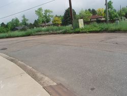
An attempt was made to mark it off, but a lady chased away marker claiming kids would end up playing in the street if they saw it. Marker moved a bit north of the playground. Boulder is ridiculous. Is there an award for "dealing with uncooperative people"? I don't think even the worst farmer or rancher could match this concerned mother. Taking pictures of uncooperative people would probably make things worse though... | An attempt was made to mark it off, but a lady chased away marker claiming kids would end up playing in the street if they saw it. Marker moved a bit north of the playground. Boulder is ridiculous. Is there an award for "dealing with uncooperative people"? I don't think even the worst farmer or rancher could match this concerned mother. Taking pictures of uncooperative people would probably make things worse though... | ||
| + | |||
| + | {{High geohash | ||
| + | | latitude = 39 | ||
| + | | longitude = -105 | ||
| + | | date = 2008-05-22 | ||
| + | | name = [[User:Akedrou|Akedrou]] | ||
| + | | altitude = 5490' | ||
| + | }} | ||
[[Category:Expeditions]] | [[Category:Expeditions]] | ||
[[Category:Expeditions with photos]] | [[Category:Expeditions with photos]] | ||
[[Category:Coordinates reached]] | [[Category:Coordinates reached]] | ||
| + | {{location|US|CO|BO}} | ||
Latest revision as of 14:27, 29 January 2021
| Thu 22 May 2008 in 39,-105: 39.9728743, -105.2386965 geohashing.info google osm bing/os kml crox |
39.972874°, -105.238697°
The Denver West coordinates were reached by User:Akedrou. It is in south Boulder. A few other users are planning to get there today as well.
It took nearly 2 hours to walk from the start, but that's mostly because I got lost in Tantra Park, and walked down to Marshall Road before I realized it was on the other side of Broadway. Anyway, I Skipped home and it took 30 minutes. I also got a bagel.
An attempt was made to mark it off, but a lady chased away marker claiming kids would end up playing in the street if they saw it. Marker moved a bit north of the playground. Boulder is ridiculous. Is there an award for "dealing with uncooperative people"? I don't think even the worst farmer or rancher could match this concerned mother. Taking pictures of uncooperative people would probably make things worse though...
Akedrou earned the High geohash achievement
|
