Difference between revisions of "2010-02-06 48 8"
From Geohashing
imported>Ekorren (template only yet, report follows) |
imported>FippeBot m (Location) |
||
| (One intermediate revision by one other user not shown) | |||
| Line 19: | Line 19: | ||
<gallery perrow="4"> | <gallery perrow="4"> | ||
| + | File:2010-02-06_48_8_AlteStuttgarterStr.jpg|Random impressions along the way | ||
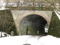
| + | File:2010-02-06_48_8_UnterfuehrungDettenhausen.jpg | ||
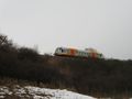
| + | File:2010-02-06_48_8_Schoenbuchbahn.jpg | ||
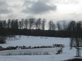
| + | File:2010-02-06_48_8_Teich_Schaichhof.jpg | ||
| + | File:2010-02-06_48_8_Eselstritt.jpg|The nearest named place to the hash: Eselstritt ("donkey kick") | ||
| + | File:2010-02-06_48_8_Grenzstein.jpg|Old border marker, an "Oberamt" was a type of district until the 19th century | ||
| + | File:2010-02-06_48_8_Gabeleiche.jpg|Gabeleiche ("fork oak") | ||
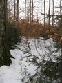
| + | File:2010-02-06_48_8_NotAWay.jpg|This isn't really a way. | ||
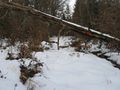
| + | File:2010-02-06_48_8_Mud.jpg|Snow, water, mud? Whatever - it's wet and cold. | ||
| + | File:2010-02-06_48_8_Hashpoint.jpg|The hashpoint | ||
| + | File:2010-02-06_48_8_GPS.jpg|Coordinates reached (got closer, but not with 16:00 on the display) | ||
| + | File:2010-02-06_48_8_Marker.jpg|Marker and hashcat | ||
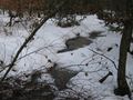
| + | File:2010-02-06_48_8_Water.jpg|Unexpected body of water | ||
</gallery> | </gallery> | ||
| Line 25: | Line 38: | ||
[[Category:Expeditions with photos]] | [[Category:Expeditions with photos]] | ||
[[Category:Coordinates reached]] | [[Category:Coordinates reached]] | ||
| + | {{location|DE|BW|BB}} | ||
Latest revision as of 00:46, 9 August 2019
| Sat 6 Feb 2010 in 48,8: 48.6074741, 8.9902612 geohashing.info google osm bing/os kml crox |
Contents
Location
Deep in the Schönbuch forest, on a spot that belongs to Altdorf (Kreis Böblingen)
Participants
Expedition
Photos
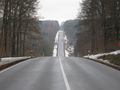
Random impressions along the way
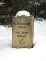
The nearest named place to the hash: Eselstritt ("donkey kick")
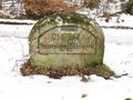
Old border marker, an "Oberamt" was a type of district until the 19th century
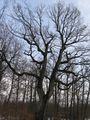
Gabeleiche ("fork oak")
This isn't really a way.
Snow, water, mud? Whatever - it's wet and cold.
The hashpoint
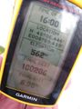
Coordinates reached (got closer, but not with 16:00 on the display)
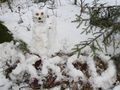
Marker and hashcat
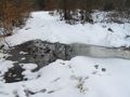
Unexpected body of water


