Difference between revisions of "2010-03-19 50 11"
imported>Reinhard m |
imported>FippeBot m (Location) |
||
| (6 intermediate revisions by one other user not shown) | |||
| Line 5: | Line 5: | ||
| date=2010-03-19 | | date=2010-03-19 | ||
}} | }} | ||
| + | == Participants == | ||
| + | * [[User:Reinhard|Reinhard]] | ||
| + | |||
| + | == Expedition == | ||
| + | |||
| + | The weather finally got nicer after the long winter and forecast said it would also be fine on Friday, so [[User:Reinhard|Reinhard]] took the afternoon off from work and cycled from Jena/Cospeda to Manu's parents in Schleusingerneundorf, where Manu already awaited him since she took the whole day off. Friday's hashpoint was nearly on his way, not far from B87 near Kranichfeld in a forest. That was also a good chance to test the new marvelous bike that Reinhard had bought few weeks before, but had only riden less than 20 km. The trip was 94 km and the bike was running just wonderful, though there was a strong headwind from southwest all the way. | ||
| + | |||
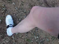
| + | In Kranichfeld, Reinhard left the B87 and took the small road to Zieglersgrund, which is just some houses within an idyllic clearance. From there it was 450 m on a forest path, which was mostly ridable. The hashpoint was then 60 m into the wood, which was badly dominated by brushwood. Too much of it had thorns and nearly made Reinhard giving up. It was really impossible to go through there without being hurt or ripping your clothes. Reinhard tried several "ways" and made use of overthrown trees, but nevertheless got himself many scratches, especially at his legs. Since it took so long (and he couldn't see his bike when the terrain got flat after the ascent), he was also a bit afraid of someone noticing his bike standing alone at the side of the path, but obviously nobody was walking by. Eventually, he found a stump which must have been very close to the exact coordinates and was glad that he would only have to get back to the path now. | ||
| + | |||
| + | After that, Reinhard was relieved to be back on his bike and enjoyed the rest of the ride to Manu, crossing the Thuringian forest on his way. He got there around 18:20, when it was nearly beginning to get dark. | ||
| + | |||
| + | Summary: Evil hashpoint, bad headwind, nice bike. | ||
| + | |||
| + | |||
| + | ===New Achievements=== | ||
| + | {{Velociraptor geohash | latitude = 50 | longitude = 11 | date = 2010-03-19 | name = Reinhard | image = 20100319-50N11E-10.jpg }} | ||
| − | |||
{{gallery|width=200|height=200|lines=3 | {{gallery|width=200|height=200|lines=3 | ||
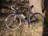
| − | |Image:20100319-50N11E-01.jpg|Reinhard's new bike at | + | |Image:20100319-50N11E-01.jpg|Reinhard's new bike at its 1st geohashing expedition. |
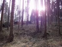
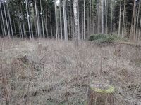
|Image:20100319-50N11E-02.jpg|View from the path towards the hashpoint (about 60 m). | |Image:20100319-50N11E-02.jpg|View from the path towards the hashpoint (about 60 m). | ||
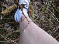
|Image:20100319-50N11E-03.jpg|That hurt! And it was fixed enough (at two points, the 2nd is hardly visible) to take a photo. | |Image:20100319-50N11E-03.jpg|That hurt! And it was fixed enough (at two points, the 2nd is hardly visible) to take a photo. | ||
| Line 16: | Line 31: | ||
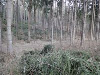
|Image:20100319-50N11E-05.jpg|View from the hashpoint towards the path (not visible). | |Image:20100319-50N11E-05.jpg|View from the hashpoint towards the path (not visible). | ||
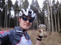
|Image:20100319-50N11E-06.jpg|Ritchie was glad to travel safely in the backpack. | |Image:20100319-50N11E-06.jpg|Ritchie was glad to travel safely in the backpack. | ||
| − | |Image:20100319-50N11E-07.jpg|Both at the hashpoint. You | + | |Image:20100319-50N11E-07.jpg|Both at the hashpoint. You may see Reinhard's cold sweat. |
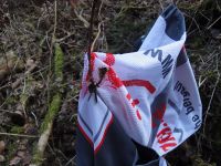
| − | |Image:20100319-50N11E-08.jpg|The plants wanted to keep | + | |Image:20100319-50N11E-08.jpg|The plants wanted to keep Reinhard's wind vest. Had to take it off to free himself. |
|Image:20100319-50N11E-09.jpg|Hooray! The bike's still there. | |Image:20100319-50N11E-09.jpg|Hooray! The bike's still there. | ||
| − | |Image:20100319-50N11E-10.jpg|Ouch. But believe me, it looked worse the next day. | + | |Image:20100319-50N11E-10.jpg|Ouch. But believe me, it looked even worse the next day. |
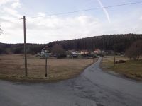
|Image:20100319-50N11E-11.jpg|Nice Zieglersgrund. | |Image:20100319-50N11E-11.jpg|Nice Zieglersgrund. | ||
}} | }} | ||
| Line 27: | Line 42: | ||
[[Category:Expeditions with photos]] | [[Category:Expeditions with photos]] | ||
[[Category:Coordinates reached]] | [[Category:Coordinates reached]] | ||
| + | {{location|DE|TH|AP}} | ||
Latest revision as of 01:15, 9 August 2019
| Fri 19 Mar 2010 in 50,11: 50.8634566, 11.1850407 geohashing.info google osm bing/os kml crox |
Participants
Expedition
The weather finally got nicer after the long winter and forecast said it would also be fine on Friday, so Reinhard took the afternoon off from work and cycled from Jena/Cospeda to Manu's parents in Schleusingerneundorf, where Manu already awaited him since she took the whole day off. Friday's hashpoint was nearly on his way, not far from B87 near Kranichfeld in a forest. That was also a good chance to test the new marvelous bike that Reinhard had bought few weeks before, but had only riden less than 20 km. The trip was 94 km and the bike was running just wonderful, though there was a strong headwind from southwest all the way.
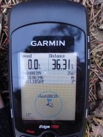
In Kranichfeld, Reinhard left the B87 and took the small road to Zieglersgrund, which is just some houses within an idyllic clearance. From there it was 450 m on a forest path, which was mostly ridable. The hashpoint was then 60 m into the wood, which was badly dominated by brushwood. Too much of it had thorns and nearly made Reinhard giving up. It was really impossible to go through there without being hurt or ripping your clothes. Reinhard tried several "ways" and made use of overthrown trees, but nevertheless got himself many scratches, especially at his legs. Since it took so long (and he couldn't see his bike when the terrain got flat after the ascent), he was also a bit afraid of someone noticing his bike standing alone at the side of the path, but obviously nobody was walking by. Eventually, he found a stump which must have been very close to the exact coordinates and was glad that he would only have to get back to the path now.
After that, Reinhard was relieved to be back on his bike and enjoyed the rest of the ride to Manu, crossing the Thuringian forest on his way. He got there around 18:20, when it was nearly beginning to get dark.
Summary: Evil hashpoint, bad headwind, nice bike.
New Achievements
Reinhard earned the Velociraptor Geohash Achievement
|
|
