Difference between revisions of "2010-03-23 50 11"
imported>Reinhard (and again) |
imported>FippeBot m (Location) |
||
| (One intermediate revision by one other user not shown) | |||
| Line 5: | Line 5: | ||
| date=2010-03-23 | | date=2010-03-23 | ||
}} | }} | ||
| + | == Participants == | ||
| + | * [[User:Reinhard|Reinhard]] | ||
| + | |||
| + | == Expedition == | ||
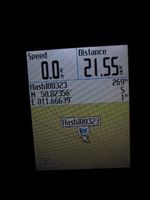
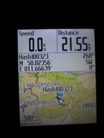
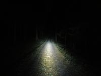
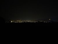
Weather was nice and the hashpoint too close not to go there. [[User:Reinhard|Reinhard]] made this a short bike trip in the evening, which he started at 20:00 from home. Less than an hour later, he was leaving Unterbodnitz using a forest path for some hundred meters, which went directly through the hashpoint. Reinhard managed to take a photo of the GPS device showing a distance to the hash of 1 m. Less wasn't possible within reasonable time, because the trees were confusing the GPS calculator. Reinhard found another way out of the forest and also took a different way back to Jena. He got home shortly after 22:00 after cycling 44 km – with his old bike, since he hadn't found a good solution for mounting the headlight to his new bike. | Weather was nice and the hashpoint too close not to go there. [[User:Reinhard|Reinhard]] made this a short bike trip in the evening, which he started at 20:00 from home. Less than an hour later, he was leaving Unterbodnitz using a forest path for some hundred meters, which went directly through the hashpoint. Reinhard managed to take a photo of the GPS device showing a distance to the hash of 1 m. Less wasn't possible within reasonable time, because the trees were confusing the GPS calculator. Reinhard found another way out of the forest and also took a different way back to Jena. He got home shortly after 22:00 after cycling 44 km – with his old bike, since he hadn't found a good solution for mounting the headlight to his new bike. | ||
| Line 24: | Line 28: | ||
[[Category:Expeditions with photos]] | [[Category:Expeditions with photos]] | ||
[[Category:Coordinates reached]] | [[Category:Coordinates reached]] | ||
| + | {{location|DE|TH|SHK}} | ||
Latest revision as of 01:18, 9 August 2019
| Tue 23 Mar 2010 in 50,11: 50.8235599, 11.6663927 geohashing.info google osm bing/os kml crox |
Participants
Expedition
Weather was nice and the hashpoint too close not to go there. Reinhard made this a short bike trip in the evening, which he started at 20:00 from home. Less than an hour later, he was leaving Unterbodnitz using a forest path for some hundred meters, which went directly through the hashpoint. Reinhard managed to take a photo of the GPS device showing a distance to the hash of 1 m. Less wasn't possible within reasonable time, because the trees were confusing the GPS calculator. Reinhard found another way out of the forest and also took a different way back to Jena. He got home shortly after 22:00 after cycling 44 km – with his old bike, since he hadn't found a good solution for mounting the headlight to his new bike.
|
I'm afraid, I was the last one here, again.
Reinhard earned the Last man standing achievement
|


