Difference between revisions of "2008-05-22 40 -96"
imported>Spike m |
imported>FippeBot m (Location) |
||
| (5 intermediate revisions by 4 users not shown) | |||
| Line 1: | Line 1: | ||
| − | + | {{meetup graticule | |
| + | | map=<map lat="40" lon="-96" date="2008-05-22" /> | ||
| + | | lat=40 | ||
| + | | lon=-96 | ||
| + | | date=2008-05-22 | ||
| + | }} | ||
| − | == | + | This date's coordinates were the first reached by a team of three members from the [[Lincoln, Nebraska|Lincoln, NE]] graticule, and most likely the first coordinates to be reached in this graticule. Unfortunately, no one thought to take a picture actually showing the coordinates with us there with them, so all these are to be taken on faith. |
| + | |||
| + | == About == | ||
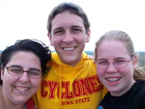
[[Image:2008-05-22_Lincoln1.jpg|thumb|300 px| The adventurous team.]] | [[Image:2008-05-22_Lincoln1.jpg|thumb|300 px| The adventurous team.]] | ||
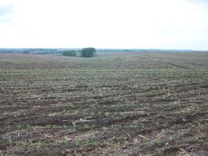
[[Image:2008-05-22_Lincoln2.jpg|thumb|300 px| The view to the northwest.]] | [[Image:2008-05-22_Lincoln2.jpg|thumb|300 px| The view to the northwest.]] | ||
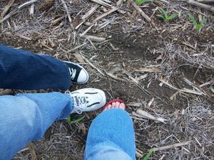
[[Image:2008-05-22_Lincoln3.jpg|thumb|300 px| The exact coordinates (to within a few meters).]] | [[Image:2008-05-22_Lincoln3.jpg|thumb|300 px| The exact coordinates (to within a few meters).]] | ||
| + | |||
| + | The team arrived at the coordinates at approximately 5:00pm local time. The group included [[User:Spike|Spike]] and his two friends, Brittany and Michelle. It was quite interesting to see how much the area had changed since the last time Google Maps last took satellite photos of the area (for example, the apparently recent construction of several new homes in the area and removal of smaller wooded areas). Once the mission was complete, the team noticed that they were but a few miles from Platte River State Park, and so they made a secondary excursion there, finding beautiful scenery and a plethora of mosquitoes and mud. | ||
| + | |||
| + | [[Category:Expeditions]] | ||
| + | [[Category:Expeditions with photos]] | ||
| + | [[Category:Coordinates reached]] | ||
| + | {{location|US|NE|CS}} | ||
Latest revision as of 01:12, 6 August 2019
| Thu 22 May 2008 in 40,-96: 40.9728743, -96.2386965 geohashing.info google osm bing/os kml crox |
This date's coordinates were the first reached by a team of three members from the Lincoln, NE graticule, and most likely the first coordinates to be reached in this graticule. Unfortunately, no one thought to take a picture actually showing the coordinates with us there with them, so all these are to be taken on faith.
About
The team arrived at the coordinates at approximately 5:00pm local time. The group included Spike and his two friends, Brittany and Michelle. It was quite interesting to see how much the area had changed since the last time Google Maps last took satellite photos of the area (for example, the apparently recent construction of several new homes in the area and removal of smaller wooded areas). Once the mission was complete, the team noticed that they were but a few miles from Platte River State Park, and so they made a secondary excursion there, finding beautiful scenery and a plethora of mosquitoes and mud.


