Difference between revisions of "2010-04-25 50 11"
imported>Reinhard (gallery) |
imported>FippeBot m (Location) |
||
| (4 intermediate revisions by one other user not shown) | |||
| Line 1: | Line 1: | ||
| − | |||
| − | |||
| − | |||
| − | |||
| − | |||
| − | |||
{{meetup graticule | {{meetup graticule | ||
| lat=50 | | lat=50 | ||
| Line 14: | Line 8: | ||
__NOTOC__ | __NOTOC__ | ||
== Location == | == Location == | ||
| − | + | In Steigerwald forest south of Erfurt. Few kilometers from the city. | |
== Participants == | == Participants == | ||
| Line 21: | Line 15: | ||
== Expedition == | == Expedition == | ||
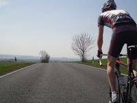
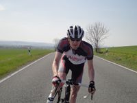
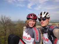
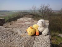
| − | + | Manu and Reinhard celebrated Reinhard's birthday in Erfurt on Saturday and planned to cycle on Sunday anyway, so the close hashpoint was a perfect start for the round trip. Having lived in Erfurt for 18 years, Reinhard knew the Steigerwald very well and found the area of the hashpoint without any difficulties. On the way they even drove through the [[2009-07-18_50_11|2009-07-18 hashpoint]]. According to the topographic map there should have been a track passing the hashpoint quite close, but Manu and Reinhard couldn't find it, so they rode a rectangle around the hashpoint on small forest paths and decided where to leave the paths afterwards. Thus it was about a 200 m walk through the bright forest with a wonderful carpet of anemones. At the hashpoint, Manu and Reinhard rested for some minutes and continued walking back on a path. Then they rode on through various villages and through the city of Arnstadt and [http://www.quaeldich.de/paesse/wachsenburg/ climbed the hill to castle Wachsenburg]. From there they headed back towards Erfurt, having another stop at a friends' garden. At the end it was a very nice 56 km tour. This is how to spend your Sunday afternoon! | |
== Photos == | == Photos == | ||
{{gallery|width=200|height=200|lines=2 | {{gallery|width=200|height=200|lines=2 | ||
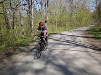
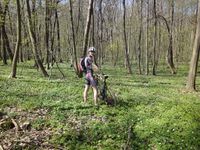
| − | |Image:20100425-50N11E-01.jpg|. | + | |Image:20100425-50N11E-01.jpg|It started on forest roads. |
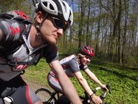
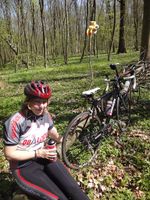
| − | |Image:20100425-50N11E-02.jpg|. | + | |Image:20100425-50N11E-02.jpg|Manu and Reinhard were enjoying the April sun. |
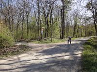
| − | |Image:20100425-50N11E-03.jpg|. | + | |Image:20100425-50N11E-03.jpg|[[2009-07-18_50_11|2009-07-18]] revisited. |
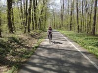
| − | |Image:20100425-50N11E-04.jpg|. | + | |Image:20100425-50N11E-04.jpg|Another forest road. |
| − | |Image:20100425-50N11E-05.jpg|. | + | |Image:20100425-50N11E-05.jpg|Narrow forest path. |
| − | |Image:20100425-50N11E-06.jpg|. | + | |Image:20100425-50N11E-06.jpg|Single trail. |
| − | |Image:20100425-50N11E-07.jpg|. | + | |Image:20100425-50N11E-07.jpg|Into the woods. |
| − | |Image:20100425-50N11E-08.jpg|. | + | |Image:20100425-50N11E-08.jpg|Coordinates reached. |
| − | |Image:20100425-50N11E-09.jpg|. | + | |Image:20100425-50N11E-09.jpg|Reinhard at the hashpoint. |
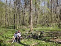
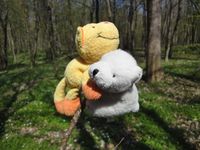
| − | |Image:20100425-50N11E-10.jpg|. | + | |Image:20100425-50N11E-10.jpg|2 human beings, 2 hashcots and 2 bikes at the hashpoint. |
| − | |Image:20100425-50N11E-11.jpg|. | + | |Image:20100425-50N11E-11.jpg|Resting. |
| − | |Image:20100425-50N11E-12.jpg|. | + | |Image:20100425-50N11E-12.jpg|And climbing. |
| − | |Image:20100425-50N11E-13.jpg|. | + | |Image:20100425-50N11E-13.jpg|Photo shooting part 1. |
| − | |Image:20100425-50N11E-14.jpg|. | + | |Image:20100425-50N11E-14.jpg|Photo shooting part 2. |
| − | |Image:20100425-50N11E-15.jpg|. | + | |Image:20100425-50N11E-15.jpg|On [http://de.wikipedia.org/wiki/Wachsenburg castle Wachsenburg]. |
| − | |Image:20100425-50N11E-16.jpg|. | + | |Image:20100425-50N11E-16.jpg|Dito. |
}} | }} | ||
| Line 47: | Line 41: | ||
[[Category:Coordinates reached]] | [[Category:Coordinates reached]] | ||
| + | {{location|DE|TH|EF}} | ||
Latest revision as of 01:47, 9 August 2019
| Sun 25 Apr 2010 in 50,11: 50.9440030, 11.0453958 geohashing.info google osm bing/os kml crox |
Location
In Steigerwald forest south of Erfurt. Few kilometers from the city.
Participants
Expedition
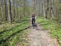
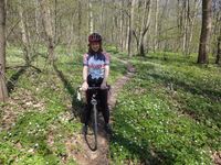
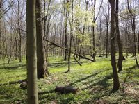
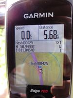
Manu and Reinhard celebrated Reinhard's birthday in Erfurt on Saturday and planned to cycle on Sunday anyway, so the close hashpoint was a perfect start for the round trip. Having lived in Erfurt for 18 years, Reinhard knew the Steigerwald very well and found the area of the hashpoint without any difficulties. On the way they even drove through the 2009-07-18 hashpoint. According to the topographic map there should have been a track passing the hashpoint quite close, but Manu and Reinhard couldn't find it, so they rode a rectangle around the hashpoint on small forest paths and decided where to leave the paths afterwards. Thus it was about a 200 m walk through the bright forest with a wonderful carpet of anemones. At the hashpoint, Manu and Reinhard rested for some minutes and continued walking back on a path. Then they rode on through various villages and through the city of Arnstadt and climbed the hill to castle Wachsenburg. From there they headed back towards Erfurt, having another stop at a friends' garden. At the end it was a very nice 56 km tour. This is how to spend your Sunday afternoon!
Photos
|
