Difference between revisions of "2010-04-30 47 13"
imported>Manu (new expedition page ( on the authority of Reinhard)) |
m (per Renaming Proposal) |
||
| (4 intermediate revisions by 2 users not shown) | |||
| Line 16: | Line 16: | ||
== Expedition == | == Expedition == | ||
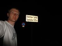
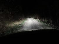
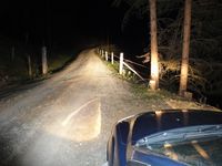
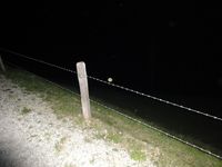
| − | + | After finishing work on Friday afternoon, I drove from Jena to Austria to the annual quaeldich.de editor meeting in Goldegg (federal state Salzburg). I'd planned to get the virgin gehoash for 47 13 for quite a while and was delighted to have the Friday and Sunday hashpoint not far from Goldegg and easily reachable. As I was leaving on Sunday and didn't know, whether I would go on a bike adventure with some of the other guys on Sunday, I decided to head for the Friday hash, although it was quite dark, when I got there around half past nine. Instead of using the 311 via St. Johann im Pongau I turned right near Bischofshofen towards Dienten am Hochkönig. I know the pass road of [http://www.quaeldich.de/paesse/dientener-sattel/ Dientner Sattel], since I had cycled it in both directions in previous years. At the pass sign I did a quick stop and took a photo and then drove down on the west side through Dienten am Hochkönig. After some kilometers I reached the small settlement of Sonnberg, where I turned left onto a small road. As expected, this was only a gravel road, more like a broad hiking trail, but one could drive there. So I did, not to lose that much time and stopped only 200 m before the hashpoint, where the road was a bit wider. I took my bike lamp, the camera and the GPS device and walked on until I was close enough to go directly to the hashpoint. I had to crawl underneath a barbwire fence, which was surely for keeping cows from leaving the meadow and not for keeping people out of it. There was no further evidence for cows being there anyway. The meadow was really steep, but I managed not to fall and found the hashpoint about 80 m from the road. It's really a pity that I couldn't take better photos of that first geohash in 47 13, because the Alpine scenery must look beautiful in daylight. Well, I couldn't wait for sunrise, so I got back to the car and drove on to my destination. | |
| − | == Photos == | + | == Photos == |
| + | {{gallery|width=200|height=200|lines=2 | ||
| + | |Image:20100430-57N13E-01.jpg|Stop at Dientner Sattel. | ||
| + | |Image:20100430-57N13E-02.jpg|Driving on gravel road. | ||
| + | |Image:20100430-57N13E-03.jpg|Car parked. 200 m to the geohash, to the right of the road. | ||
| + | |Image:20100430-57N13E-04.jpg|Cross that fence and climb down the meadow. | ||
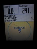
| + | |Image:20100430-57N13E-05.jpg|Coordinates reached in virgin graticule! | ||
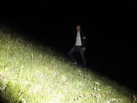
| + | |Image:20100430-57N13E-06.jpg|That was the slope down to the hashpoint. | ||
| + | |Image:20100430-57N13E-07.jpg|Kind of view from the hashpoint. | ||
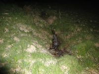
| + | |Image:20100430-57N13E-08.jpg|A brook 15 m from the hashpoint. | ||
| + | }} | ||
== Achievements == | == Achievements == | ||
| − | {{ | + | {{Graticule unlocked | latitude = 47 | longitude = 13 | date = 2010-04-30 | name = [[User:Reinhard|Reinhard]]}} |
[[Category:Expeditions]] | [[Category:Expeditions]] | ||
[[Category:Expeditions with photos]] | [[Category:Expeditions with photos]] | ||
[[Category:Coordinates reached]] | [[Category:Coordinates reached]] | ||
| + | {{location|AT|S|ZE}} | ||
Latest revision as of 06:13, 20 March 2024
| Fri 30 Apr 2010 in 47,13: 47.3599056, 13.0141990 geohashing.info google osm bing/os kml crox |
Location
This geo hash lies on a meadow and should be (easily?) accessible.
Participants
Plans
Reinhard plans to visit the hash on his way to Goldegg on Friday evening.
Expedition
After finishing work on Friday afternoon, I drove from Jena to Austria to the annual quaeldich.de editor meeting in Goldegg (federal state Salzburg). I'd planned to get the virgin gehoash for 47 13 for quite a while and was delighted to have the Friday and Sunday hashpoint not far from Goldegg and easily reachable. As I was leaving on Sunday and didn't know, whether I would go on a bike adventure with some of the other guys on Sunday, I decided to head for the Friday hash, although it was quite dark, when I got there around half past nine. Instead of using the 311 via St. Johann im Pongau I turned right near Bischofshofen towards Dienten am Hochkönig. I know the pass road of Dientner Sattel, since I had cycled it in both directions in previous years. At the pass sign I did a quick stop and took a photo and then drove down on the west side through Dienten am Hochkönig. After some kilometers I reached the small settlement of Sonnberg, where I turned left onto a small road. As expected, this was only a gravel road, more like a broad hiking trail, but one could drive there. So I did, not to lose that much time and stopped only 200 m before the hashpoint, where the road was a bit wider. I took my bike lamp, the camera and the GPS device and walked on until I was close enough to go directly to the hashpoint. I had to crawl underneath a barbwire fence, which was surely for keeping cows from leaving the meadow and not for keeping people out of it. There was no further evidence for cows being there anyway. The meadow was really steep, but I managed not to fall and found the hashpoint about 80 m from the road. It's really a pity that I couldn't take better photos of that first geohash in 47 13, because the Alpine scenery must look beautiful in daylight. Well, I couldn't wait for sunrise, so I got back to the car and drove on to my destination.
Photos
|
Achievements
Reinhard earned the Graticule Unlocked Achievement
|
