Difference between revisions of "2010-05-18 55 13"
imported>Fasanen (→Photos) |
imported>FippeBot m (Location) |
||
| (2 intermediate revisions by one other user not shown) | |||
| Line 8: | Line 8: | ||
== Location == | == Location == | ||
| − | Playground for armoured South Skåne Regiment (P7) just outside Revingeby. | + | Playground for armoured [[wikipedia:S%C3%B6dra_sk%C3%A5nska_regementet | South Skåne Regiment]] (P7) just outside Revingeby. |
== Participants == | == Participants == | ||
| Line 39: | Line 39: | ||
File:1005185513 09.jpg|That's it. Pack it! | File:1005185513 09.jpg|That's it. Pack it! | ||
</gallery> | </gallery> | ||
| − | |||
| − | |||
| − | |||
| − | |||
[[Category:Expeditions]] | [[Category:Expeditions]] | ||
[[Category:Coordinates reached]] | [[Category:Coordinates reached]] | ||
[[Category:Expeditions with photos]] | [[Category:Expeditions with photos]] | ||
| − | |||
| − | |||
| − | |||
| − | |||
| − | |||
| − | |||
| − | |||
| − | + | == Achievements == | |
| − | + | {{#vardefine:ribbonwidth|800px}} | |
| − | -- | + | {{land geohash | latitude=55 | longitude=13 | date=2010-05-18 | name=Fasanen }} |
| − | + | {{location|SE|M}} | |
| − | |||
| − | |||
| − | |||
| − | |||
Latest revision as of 02:02, 9 August 2019
| Tue 18 May 2010 in 55,13: 55.7206858, 13.4472918 geohashing.info google osm bing/os kml crox |
Location
Playground for armoured South Skåne Regiment (P7) just outside Revingeby.
Participants
Plans
Last minute decision. No other than trying to reach the hash after work.
Expedition
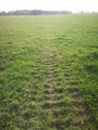
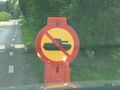
After work weather was nice and I had no immediate obligations. Why not go for today's geohash? Google maps showed characteristic marks of irregualar catepillar threads all over the area, indicating the training grounds for heavy tanks from the nearby armoured regiment P7. If there was no action in the area it should be easily accessed.
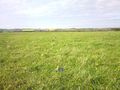
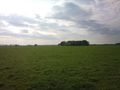
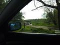
I drove the car on a gravel road and stopped 300 meters from the hash point. Terrain was flat as a pancake and covered by short grass. When not used by heavy armour this land is roamed by cattle. Clear evidence of that was the amount of cow droppings all over the place. I had to watch my step from cow dung, but got to the hashpoint without trouble and documented.
On my way back home, I realised that there actually was quite some military training happening. I passed some GI:s with their faces camo-painted having som kind of roadblock thing going. They seemed quite bored though. I saw some more military action before I finally got home.
Photos
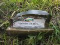
Abandoned expedition porridge.
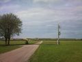
Parking looking N.
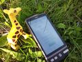
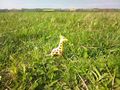
Giraffe@hash.
Giraffe@hash.
The car from 300 meters away.
Giraffe getting pissed off...
It ain't me babe...
GI:s marching towards glory.
That's it. Pack it!


Achievements
Fasanen earned the Land geohash achievement
|