Difference between revisions of "2010-06-21 50 11"
imported>Reinhard (Created page with '{{subst:Expedition |lat = 50 |lon = 11 |date = 2010-06-21 }}') |
imported>FippeBot m (Location) |
||
| (3 intermediate revisions by one other user not shown) | |||
| Line 1: | Line 1: | ||
| − | |||
<!-- If you did not specify these parameters in the template, please substitute appropriate things for IMAGE, LAT, LON, and DATE (YYYY-MM-DD format) | <!-- If you did not specify these parameters in the template, please substitute appropriate things for IMAGE, LAT, LON, and DATE (YYYY-MM-DD format) | ||
| Line 15: | Line 14: | ||
__NOTOC__ | __NOTOC__ | ||
== Location == | == Location == | ||
| − | + | Right beside A4 exit Rüdersdorf. | |
== Participants == | == Participants == | ||
| − | + | * [[user:Reinhard|Reinhard]] | |
| − | |||
| − | |||
| − | |||
== Expedition == | == Expedition == | ||
| − | + | It was going to be the longest "day" of the year and Reinhard needed to take his bike out for a ride. The hashpoint lay conveniently close for a nice 103 km bike trip after work, so that's what Reinhard did, starting at 18:15 in Jena. After approaching the Autobahn exit Rüdersdorf, he quickly found the gravel road, which lead close (8 m) to the hashpoint. The exact spot might have been within a field of plants that Reinhard can't name due to his lack of botanical knowledge, but by stepping to the edge of the field, he made the GPS device show a distance of only 5 m and did not want to jump further into the field, though he wasn't sure, whether it was still in use (there were some different plants within the field (like poppy)). Reinhard took the usual photos and rode on home, where he got 22:45 quite a while after sunset. | |
| − | |||
| − | |||
| − | |||
== Photos == | == Photos == | ||
| − | + | {{gallery|width=200|height=200|lines=2 | |
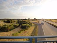
| − | Image: | + | |Image:20100621-50N11E-01.jpg|View towards the hashpoint. |
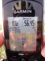
| − | -- | + | |Image:20100621-50N11E-02.jpg|That should be okay. |
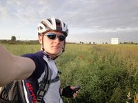
| − | + | |Image:20100621-50N11E-03.jpg|At the hashpoint. | |
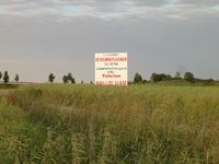
| − | + | |Image:20100621-50N11E-04.jpg|Anybody want to buy industrial real estates at a hashpoint? | |
| + | }} | ||
| − | |||
| − | |||
| − | |||
| − | |||
| − | |||
| − | |||
| − | |||
| − | |||
| − | |||
| − | |||
| − | |||
| − | |||
| − | |||
| − | |||
[[Category:Expeditions]] | [[Category:Expeditions]] | ||
| − | |||
[[Category:Expeditions with photos]] | [[Category:Expeditions with photos]] | ||
| − | |||
| − | |||
| − | |||
| − | |||
| − | |||
[[Category:Coordinates reached]] | [[Category:Coordinates reached]] | ||
| − | + | {{location|DE|TH|GRZ}} | |
| − | |||
| − | |||
| − | |||
| − | |||
| − | |||
| − | |||
| − | |||
| − | |||
| − | |||
Latest revision as of 02:29, 9 August 2019
| Mon 21 Jun 2010 in 50,11: 50.8959923, 11.9775894 geohashing.info google osm bing/os kml crox |
Location
Right beside A4 exit Rüdersdorf.
Participants
Expedition
It was going to be the longest "day" of the year and Reinhard needed to take his bike out for a ride. The hashpoint lay conveniently close for a nice 103 km bike trip after work, so that's what Reinhard did, starting at 18:15 in Jena. After approaching the Autobahn exit Rüdersdorf, he quickly found the gravel road, which lead close (8 m) to the hashpoint. The exact spot might have been within a field of plants that Reinhard can't name due to his lack of botanical knowledge, but by stepping to the edge of the field, he made the GPS device show a distance of only 5 m and did not want to jump further into the field, though he wasn't sure, whether it was still in use (there were some different plants within the field (like poppy)). Reinhard took the usual photos and rode on home, where he got 22:45 quite a while after sunset.
Photos
|


