Difference between revisions of "2010-08-29 46 -124"
From Geohashing
imported>Michael5000 (→Participants) |
m (per Renaming Proposal) |
||
| (7 intermediate revisions by 3 users not shown) | |||
| Line 1: | Line 1: | ||
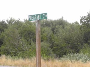
| + | [[File:2010-08-29 46 -124 Streetsign.JPG|thumb|left|300px|The hashpoint is in the vacant lot behind this streetsign.]] | ||
| − | |||
| − | |||
| − | |||
| − | |||
| − | |||
| − | |||
| − | |||
| − | |||
| − | |||
{{meetup graticule | {{meetup graticule | ||
| lat=46 | | lat=46 | ||
| Line 15: | Line 7: | ||
}} | }} | ||
| − | |||
__NOTOC__ | __NOTOC__ | ||
== Location == | == Location == | ||
| Line 25: | Line 16: | ||
*[[User:Michael5000|Michael5000]] | *[[User:Michael5000|Michael5000]] | ||
| − | == | + | == Expedition == |
| − | |||
| − | + | From base camp in Hoquiam, I drove out to the Ocean Shores Penninsula, arriving at 8 a.m. and parking on Razorclam Drive, which I picked for the goofy name. Someone clearly had BIG BIG real estate dreams for Ocean Shores at some point, but that train has been slow in coming and a high-end infrastructure supports a scattering of spec housing. | |
| − | + | ||
| + | So it is that the hashpoint falls on a wooded vacant corner lot. I ran by, then ducked into the bushes to get myself on the actual point, which was under a tree. I popped back out and continued a nice 2 1/2 mile jog. Afterwards, I did a drive-by to get a few pictures. | ||
| − | |||
| − | |||
== Photos == | == Photos == | ||
| + | |||
| + | Eventually! | ||
<!-- Insert pictures between the gallery tags using the following format: | <!-- Insert pictures between the gallery tags using the following format: | ||
Image:2010-##-## ## ## Alpha.jpg | Witty Comment | Image:2010-##-## ## ## Alpha.jpg | Witty Comment | ||
| Line 43: | Line 34: | ||
== Achievements == | == Achievements == | ||
{{#vardefine:ribbonwidth|800px}} | {{#vardefine:ribbonwidth|800px}} | ||
| − | |||
| + | * Land Geohash | ||
| − | + | {{Graticule unlocked | |
| − | + | | latitude = 46 | |
| − | [[ | + | | longitude = -124 |
| + | | date = 2010-08-29 | ||
| + | | name = [[User:Michael5000|Michael5000]] | ||
| + | }} | ||
| + | |||
| + | {{Multihash2 | count = 3 | date = 2010-08-29 | name = Michael5000}} | ||
| − | |||
| − | |||
| − | |||
| − | |||
| − | |||
[[Category:Expeditions]] | [[Category:Expeditions]] | ||
| − | |||
[[Category:Expeditions with photos]] | [[Category:Expeditions with photos]] | ||
| − | |||
| − | |||
| − | |||
| − | |||
| − | |||
[[Category:Coordinates reached]] | [[Category:Coordinates reached]] | ||
| − | + | {{location|US|WA|GY}} | |
| − | |||
| − | |||
| − | |||
| − | |||
| − | |||
| − | |||
| − | |||
| − | |||
| − | |||
Latest revision as of 06:05, 20 March 2024
| Sun 29 Aug 2010 in 46,-124: 46.9542821, -124.1512477 geohashing.info google osm bing/os kml crox |
Location
A vacant lot in Ocean Shores.
Participants
Expedition
From base camp in Hoquiam, I drove out to the Ocean Shores Penninsula, arriving at 8 a.m. and parking on Razorclam Drive, which I picked for the goofy name. Someone clearly had BIG BIG real estate dreams for Ocean Shores at some point, but that train has been slow in coming and a high-end infrastructure supports a scattering of spec housing.
So it is that the hashpoint falls on a wooded vacant corner lot. I ran by, then ducked into the bushes to get myself on the actual point, which was under a tree. I popped back out and continued a nice 2 1/2 mile jog. Afterwards, I did a drive-by to get a few pictures.
Photos
Eventually!
Achievements
- Land Geohash
Michael5000 earned the Graticule Unlocked Achievement
|
Michael5000 earned the Multihash Achievement
|
