Difference between revisions of "2010-08-29 46 -123"
imported>Michael5000 (→Participants) |
imported>FippeBot m (Location) |
||
| (6 intermediate revisions by 2 users not shown) | |||
| Line 1: | Line 1: | ||
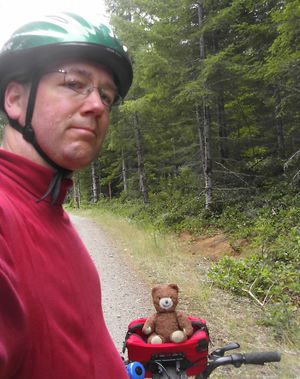
| + | [[File:2010-08-29 46 -123 Arriving.JPG|thumb|left|300px|Arriving at the vicinity of the hashpoint with assistance from forest-savvy hashscot.]] | ||
| − | |||
| − | |||
| − | |||
| − | |||
| − | |||
| − | |||
| − | |||
| − | |||
| − | |||
{{meetup graticule | {{meetup graticule | ||
| lat=46 | | lat=46 | ||
| Line 15: | Line 7: | ||
}} | }} | ||
| − | + | ||
__NOTOC__ | __NOTOC__ | ||
== Location == | == Location == | ||
| Line 25: | Line 17: | ||
*[[User:Michael5000|Michael5000]] | *[[User:Michael5000|Michael5000]] | ||
| − | + | ||
| − | |||
== Expedition == | == Expedition == | ||
| − | |||
| − | + | I approached this point from the south and west, coming up Waddell Creek Road to Sherman Valley Road. I envisioned the area being much more remote than it turned out to be, so was pretty amused to get to Norschka Road, where I had planned to park the truck and proceed on bike, to find several trucks full of young dudes with bikes. "This is what it would be like," I thought, "if geohashing went mainstream." | |
| − | + | ||
| + | I rode about 4 1/2 miles up into the hills on the "C Line" Road, most of it pretty steeply uphill. I was wearing red, which was good as there were plenty of shots ringing out, and as I approached the hashpoint I passed two dudes enjoying their Constitutional right to blaze away with the biggest, scariest looking gun I'd ever seen. I gave them the guy nod. | ||
| + | |||
| + | The C Line turned out to be a couple of hundred feet high for the hashpoint, but a convenient side road let me burn some elevation, and then an even more convenient side road that isn't on the maps took me to within 20 feet. I plunged into the forest to find.... a vacuum cleaner? What the hell? Haven't people heard of dumpsters? I almost wished I had just driven in, because there was no way to take out that kind of trash by bike. Anyway: minor bushwhacking, nailed the hashpoint, and headed back the truck, enjoying the expenditure of potential energy I had saved up on the way in. | ||
== Photos == | == Photos == | ||
| + | |||
| + | Eventually | ||
<!-- Insert pictures between the gallery tags using the following format: | <!-- Insert pictures between the gallery tags using the following format: | ||
Image:2010-##-## ## ## Alpha.jpg | Witty Comment | Image:2010-##-## ## ## Alpha.jpg | Witty Comment | ||
| Line 43: | Line 38: | ||
== Achievements == | == Achievements == | ||
{{#vardefine:ribbonwidth|800px}} | {{#vardefine:ribbonwidth|800px}} | ||
| − | + | {{Multihash2 | count = 3 | date = 2010-08-29 | name = Michael5000}} | |
| − | |||
| − | |||
| − | |||
| − | |||
| − | |||
| − | |||
| − | |||
| − | |||
[[Category:Expeditions]] | [[Category:Expeditions]] | ||
| − | |||
[[Category:Expeditions with photos]] | [[Category:Expeditions with photos]] | ||
| − | + | ||
| − | |||
| − | |||
| − | |||
| − | |||
[[Category:Coordinates reached]] | [[Category:Coordinates reached]] | ||
| − | + | {{location|US|WA|TH}} | |
| − | |||
| − | |||
| − | |||
| − | |||
| − | |||
| − | |||
| − | |||
| − | |||
| − | |||
Latest revision as of 03:31, 9 August 2019
| Sun 29 Aug 2010 in 46,-123: 46.9542821, -123.1512477 geohashing.info google osm bing/os kml crox |
Location
In the Capital State Forest, twelve miles WSW of Olympia.
Participants
Expedition
I approached this point from the south and west, coming up Waddell Creek Road to Sherman Valley Road. I envisioned the area being much more remote than it turned out to be, so was pretty amused to get to Norschka Road, where I had planned to park the truck and proceed on bike, to find several trucks full of young dudes with bikes. "This is what it would be like," I thought, "if geohashing went mainstream."
I rode about 4 1/2 miles up into the hills on the "C Line" Road, most of it pretty steeply uphill. I was wearing red, which was good as there were plenty of shots ringing out, and as I approached the hashpoint I passed two dudes enjoying their Constitutional right to blaze away with the biggest, scariest looking gun I'd ever seen. I gave them the guy nod.
The C Line turned out to be a couple of hundred feet high for the hashpoint, but a convenient side road let me burn some elevation, and then an even more convenient side road that isn't on the maps took me to within 20 feet. I plunged into the forest to find.... a vacuum cleaner? What the hell? Haven't people heard of dumpsters? I almost wished I had just driven in, because there was no way to take out that kind of trash by bike. Anyway: minor bushwhacking, nailed the hashpoint, and headed back the truck, enjoying the expenditure of potential energy I had saved up on the way in.
Photos
Eventually
Achievements
Michael5000 earned the Multihash Achievement
|
