Difference between revisions of "2010-10-07 60 10"
imported>Eiggen |
m (2020-01-01 update) |
||
| (One intermediate revision by one other user not shown) | |||
| Line 53: | Line 53: | ||
[[Category:Expeditions with photos]] | [[Category:Expeditions with photos]] | ||
[[Category:Coordinates reached]] | [[Category:Coordinates reached]] | ||
| + | {{location|NO|30}} | ||
Latest revision as of 00:28, 16 February 2020
| Thu 7 Oct 2010 in 60,10: 60.0117018, 10.4863319 geohashing.info google osm bing/os kml crox |
Location
Some forest north of Bærum.
Participants
Expedition
eiggen
I took the 16:23 143 bus at the Lysaker station. W hopped on the same bus at Bekkestua. We switched to another bus at Triangelen, and continued to Bykrysset, the final stop on the 753 line.
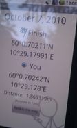
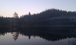
Arrived there, we had to walk about 5 km to reach the hashpoint. The road was pretty steep, going uphill. The scenery was gorgeous with autumn-colored trees and an evening sun lighting us from the horizon. We walked on a trail that surely is a nice ski track in winter, then got in the wild forest and continued for about 100 m. The ground was pretty wet and we were forced to jump over a few streams, but we did not end up too wet ourselves.
We came back following the same path, but at that time the sun was almost gone and it was a bit cold. W and me parted ways after eating two large pizzas at Dolly Dimple's, Skøyen.
Photos
|

