Difference between revisions of "2011-03-20 50 10"
imported>Reinhard (gallery) |
imported>FippeBot m (Location) |
||
| (One intermediate revision by one other user not shown) | |||
| Line 16: | Line 16: | ||
== Photos == | == Photos == | ||
| − | {{gallery|width=200|height=200|lines= | + | {{gallery|width=200|height=200|lines=3 |
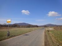
|Image:20110320-50N10E-01.jpg|Big (left) and Small (right) Equal Mountain. (How can they be equal, when they have different size?) | |Image:20110320-50N10E-01.jpg|Big (left) and Small (right) Equal Mountain. (How can they be equal, when they have different size?) | ||
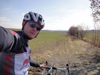
|Image:20110320-50N10E-02.jpg|420 m this way. | |Image:20110320-50N10E-02.jpg|420 m this way. | ||
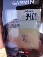
|Image:20110320-50N10E-03.jpg|Coordinates reached. | |Image:20110320-50N10E-03.jpg|Coordinates reached. | ||
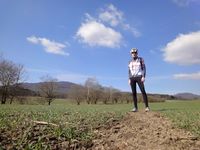
|Image:20110320-50N10E-04.jpg|Reinhard with the Big Equal Mountain in the background. | |Image:20110320-50N10E-04.jpg|Reinhard with the Big Equal Mountain in the background. | ||
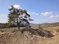
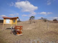
| − | |Image:20110320-50N10E-05.jpg|Relaxing on Kapellenberg. | + | |Image:20110320-50N10E-05.jpg|Relaxing on Kapellenberg. (the Equal Mountains are in the BG) |
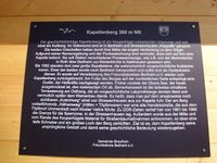
|Image:20110320-50N10E-06.jpg|Chapel Hill. | |Image:20110320-50N10E-06.jpg|Chapel Hill. | ||
|Image:20110320-50N10E-07.jpg|And again from the bottom. | |Image:20110320-50N10E-07.jpg|And again from the bottom. | ||
| Line 30: | Line 30: | ||
[[Category:Expeditions with photos]] | [[Category:Expeditions with photos]] | ||
[[Category:Coordinates reached]] | [[Category:Coordinates reached]] | ||
| + | {{location|DE|TH|HBN}} | ||
Latest revision as of 05:53, 9 August 2019
| Sun 20 Mar 2011 in 50,10: 50.3877725, 10.6268758 geohashing.info google osm bing/os kml crox |
Location
On a field at the foot of the "Großen Gleichberg" (big equal mountain).
Participants
Expedition
Since Reinhard brought his bike to Schleusingerneundorf, he had to make at least one bike trip that weekend and decided in favor of this reasonably close hashpoint. He started after a good breakfast and partly went on roads which he knew from the 2009-06-13 geohash with Manu and Thepiguy. The weather was perfect, so that Reinhard could enjoy the ride on mostly minor roads very much. Like the satellite view showed, Reinhard had to walk 420 m on a muddy field path after leaving the road and found the hashpoint just few meters beside that path in the field with view to the top of the "Großen Gleichberg". After getting back to the road and cleaning the shoes good enough to get back into the pedals (meaning the same procedure as after nearly every geohash) he rode on along different roads and found a very nice spot called "Kapellenberg" (chapel hill) between Bedheim and Straufhain, where he had a short rest, sitting down on a bench for 3 seconds, while waiting for the autotimer. He got back to Schleusingerneundorf after travelling 78 km soon enough not to miss lunch.
Photos
|
