Difference between revisions of "2011-05-23 52 13"
imported>Ekorren (Not reached - mining pit) |
imported>FippeBot m (Location) |
||
| (One intermediate revision by one other user not shown) | |||
| Line 19: | Line 19: | ||
== Photos == | == Photos == | ||
| + | <gallery> | ||
| + | File:2011-05-23_52_13_Zugverkehr_unregelmaessig.JPG|''Train traffic irregularily. Please use the tram.'' | ||
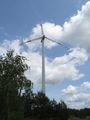
| + | File:2011-05-23_52_13_windmills.JPG|500 m from the hash. No way through here. | ||
| + | File:2011-05-23_52_13_Osterne_welcome.JPG|Welcome to Osterne. Wtf is Osterne? | ||
| + | File:2011-05-23_52_13_Ruins_1.JPG|Modern ruins | ||
| + | File:2011-05-23_52_13_rabbit.JPG|Bunny! | ||
| + | File:2011-05-23_52_13_windmill.JPG| | ||
| + | File:2011-05-23_52_13_no_trespassing.JPG|No trespassing | ||
| + | File:2011-05-23_52_13_GPS.JPG|Got as close as 100m (and forgot to take a picture at that point) | ||
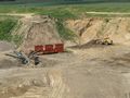
| + | File:2011-05-23_52_13_pit_1.JPG|The hash is down there, somewhere | ||
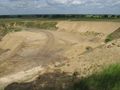
| + | File:2011-05-23_52_13_pit_2.JPG| | ||
| + | File:2011-05-23_52_13_pit_3.JPG| | ||
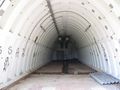
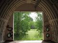
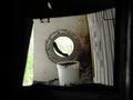
| + | File:2011-05-23_52_13_bunker_1.JPG|Abandoned bunker | ||
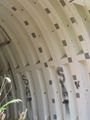
| + | File:2011-05-23_52_13_bunker_2.JPG| | ||
| + | File:2011-05-23_52_13_bunker_3.JPG| | ||
| + | File:2011-05-23_52_13_bunker_4.JPG| | ||
| + | File:2011-05-23_52_13_bunker_5.JPG| | ||
| + | File:2011-05-23_52_13_ruins_2.JPG|More modern ruins. The large living blocks are abandoned as well | ||
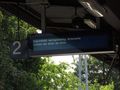
| + | File:2011-05-23_52_13_Berlin-Kopenhagen.JPG|''by bike: long distance trail Berlin-Copenhagen. Starts at the station. Length of way: 6 km.'' Hu. I always believed it was more than 6 km from Berlin to Copenhagen. | ||
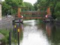
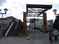
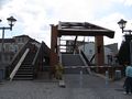
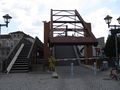
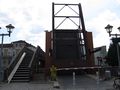
| + | File:2011-05-23_52_13_Bridge_closed.JPG| | ||
| + | File:2011-05-23_52_13_Bridge_1.JPG| | ||
| + | File:2011-05-23_52_13_Bridge_2.JPG| | ||
| + | File:2011-05-23_52_13_Bridge_3.JPG| | ||
| + | File:2011-05-23_52_13_Bridge_4.JPG| | ||
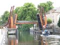
| + | File:2011-05-23_52_13_Bridge_open.JPG| | ||
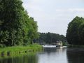
| + | File:2011-05-23_52_13_Havelkanal.JPG| | ||
| + | </gallery> | ||
[[Category:Expeditions]] | [[Category:Expeditions]] | ||
| Line 24: | Line 51: | ||
[[Category:Coordinates not reached]] | [[Category:Coordinates not reached]] | ||
[[Category:Not reached - No public access]] | [[Category:Not reached - No public access]] | ||
| + | {{location|DE|BB|OHV}} | ||
Latest revision as of 06:38, 9 August 2019
| Mon 23 May 2011 in 52,13: 52.9785131, 13.2171255 geohashing.info google osm bing/os kml crox |
Contents
Location
A mining pit between Gransee-Kraatz and Zehdenick-Osterne.
Although it looked like the border of a field on the aerials, it was clearly inside the mine, which probably had been extended since the pics were taken. Climbing down there was not an option.
Participants
Expedition
Report will be done later
Photos
Train traffic irregularily. Please use the tram.
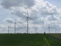
500 m from the hash. No way through here.
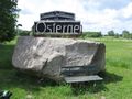
Welcome to Osterne. Wtf is Osterne?
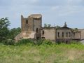
Modern ruins
Bunny!
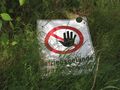
No trespassing
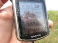
Got as close as 100m (and forgot to take a picture at that point)
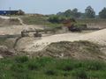
The hash is down there, somewhere
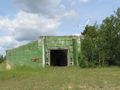
Abandoned bunker
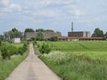
More modern ruins. The large living blocks are abandoned as well
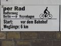
by bike: long distance trail Berlin-Copenhagen. Starts at the station. Length of way: 6 km. Hu. I always believed it was more than 6 km from Berlin to Copenhagen.