Difference between revisions of "2011-07-17 43 -118"
imported>Michael5000 |
m (per Renaming Proposal) |
||
| (3 intermediate revisions by 3 users not shown) | |||
| Line 13: | Line 13: | ||
== Participants == | == Participants == | ||
| − | |||
*[[User:Michael5000|Michael5000]] | *[[User:Michael5000|Michael5000]] | ||
*[[User:Mrs.5000|Mrs.5000]] | *[[User:Mrs.5000|Mrs.5000]] | ||
== Expedition == | == Expedition == | ||
| − | |||
This was the first known attempt to hash the Buchanan graticule. | This was the first known attempt to hash the Buchanan graticule. | ||
| Line 28: | Line 26: | ||
== Photos == | == Photos == | ||
| − | |||
| − | |||
| − | |||
<gallery perrow="5"> | <gallery perrow="5"> | ||
File:2011-07-17 43 -118 sign.JPG|This Expedition was a long ways from anywhere. | File:2011-07-17 43 -118 sign.JPG|This Expedition was a long ways from anywhere. | ||
| Line 43: | Line 38: | ||
{{#vardefine:ribbonwidth|800px}} | {{#vardefine:ribbonwidth|800px}} | ||
| − | {{ | + | {{Graticule unlocked |
| latitude = 43 | | latitude = 43 | ||
| longitude = -118 | | longitude = -118 | ||
| date = 2011-07-17 | | date = 2011-07-17 | ||
| name = [[User:Michael5000|Michael5000]] and [[User:Mrs.5000|Mrs.5000]] | | name = [[User:Michael5000|Michael5000]] and [[User:Mrs.5000|Mrs.5000]] | ||
| − | | image = | + | | image = 2011-07-17 43 -118 sign.JPG |
}} | }} | ||
| − | |||
[[Category:Expeditions]] | [[Category:Expeditions]] | ||
[[Category:Expeditions with photos]] | [[Category:Expeditions with photos]] | ||
[[Category:Coordinates reached]] | [[Category:Coordinates reached]] | ||
| + | {{location|US|OR|HA}} | ||
Latest revision as of 05:52, 20 March 2024
| Sun 17 Jul 2011 in 43,-118: 43.8187043, -118.9462660 geohashing.info google osm bing/os kml crox |

Location
A few miles east of US-395 in the Malheur National Forest.
Participants
Expedition
This was the first known attempt to hash the Buchanan graticule.
After yesterday's fiasco, I considered renouncing any further geohashing on unmaintained backroads. Approaching this hashpoint, however, I happily turned off of US-395 onto a road that quickly became a dirt track. We drove through arid upland forest to stopping point about a mile from the hashpoint, and then set off by foot. We recorded the location of the truck to make sure we could find our way back to it, and noticed that we had parked at 5276 feet -- four short of a mile.
The mountain forest presented few obstacles, except for some minor uphill and downhill and a small stream to cross. Everything smelled clean, the way things often do in the desert. We walked a little more than a mile and found our spot in a stretch of forest much like the others. We set up a little monument, took the usual pictures, and headed back to the truck. It was a 2 1/3 mile walk in and out.
Expedition Success.
Photos
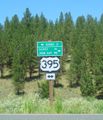
This Expedition was a long ways from anywhere.
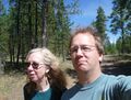
Yet we were undaunted.
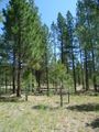
The forest area around the hashpoint.
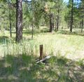
The little monument we set up.
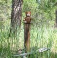
Obligatory hashscot moment.
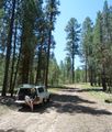
Picnic at the truck afterwards.


Achievements
Michael5000 and Mrs.5000 earned the Graticule Unlocked Achievement
|