Difference between revisions of "2011-07-24 58 17"
From Geohashing
imported>Per S |
m (per Renaming Proposal) |
||
| (One intermediate revision by one other user not shown) | |||
| Line 42: | Line 42: | ||
{| | {| | ||
| − | |{{ | + | |{{Graticule unlocked |
| latitude = 58 | | latitude = 58 | ||
| longitude = 17 | | longitude = 17 | ||
| Line 65: | Line 65: | ||
[[Category: Expeditions with photos]] | [[Category: Expeditions with photos]] | ||
[[Category: Coordinates reached]] | [[Category: Coordinates reached]] | ||
| + | {{location|SE|AB}} | ||
Latest revision as of 05:51, 20 March 2024

|
| ||||||
Location
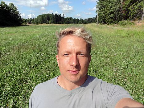
In a field close to the road at Kalvövägen 38, Nynäshamn, Sweden.
Participants
- Per S
- barngroda80
Plans
Since we are going to Nynäshamn anyway this sunday, we might as well hit this hash while there. We're traveling to Nynäshamn by commuter train and borrowing a car there to stock up for a week of sailing, so we'll drive the last stretch.
It may take a while until the page is updated with the expedition report.
Expedition
We hit the hashpoint between stocking up and leaving the dock for a week of sailing. It was easy to find, but we were in a hurry, so there are only a few pictures.
Photos
Achievements
| |||
|


