Difference between revisions of "2008-05-24 -35 148"
imported>Tjtrumpet2323 m (2008-05-24 -35,148 moved to 2008-05-24 -35 148: consistent page naming) |
m |
||
| (10 intermediate revisions by 7 users not shown) | |||
| Line 1: | Line 1: | ||
| + | {{pre30w}} | ||
| + | {{meetup graticule | ||
| + | | map=<map lat="-35" lon="148" date="2008-05-23" /> | ||
| + | | lat=-35 | ||
| + | | lon=148 | ||
| + | | date=2008-05-24 | ||
| + | }} | ||
| + | |||
==There must have been a better way== | ==There must have been a better way== | ||
| − | [[Image:PsudAndChris.jpg|thumb|300 px|Psud & Chris]][[User: | + | [[Image:PsudAndChris.jpg|thumb|300 px|Psud & Chris]][[User:Psud|Psud (Adam)]] and Chris decided that -35, 149 was too close and too easy. Not to mention being in the middle of some farmer's property. So we decided on -35, 148. An easy trip to the Brindabella Ranges, and 1300m from the road. |
The location was programmed into three GPSs, a car navigating one, a less clever one that doesn't think you should be on a road, and a mobile phone. The car GPS took us down road after road, each one more rutted and rocky than the previous. We opened gates, dodged boulders, and made our way to an erosion gully we couldn't cross. | The location was programmed into three GPSs, a car navigating one, a less clever one that doesn't think you should be on a road, and a mobile phone. The car GPS took us down road after road, each one more rutted and rocky than the previous. We opened gates, dodged boulders, and made our way to an erosion gully we couldn't cross. | ||
| Line 14: | Line 22: | ||
We didn't get a chance to play dominoes. | We didn't get a chance to play dominoes. | ||
| − | Oh, and yes, there was an easier way. Google maps shows it. Thank Ghu for Google. [[User: | + | Oh, and yes, there was an easier way. Google maps shows it. Thank Ghu for Google. [[User:Psud|Psud]] will try again tomorrow. |
Actually he won't. When calculated correctly - with Sunday's date and the most recent Dow price, all nearby spots are not much good, so Psud's going to brew beer instead. Beer is to be bottled in preparation for the first occasion when the spot lands in Canberra or her suburbs. | Actually he won't. When calculated correctly - with Sunday's date and the most recent Dow price, all nearby spots are not much good, so Psud's going to brew beer instead. Beer is to be bottled in preparation for the first occasion when the spot lands in Canberra or her suburbs. | ||
| Line 21: | Line 29: | ||
[[Image:TheCarWeDrove.png|thumb|600 px|Clunk, rattle, screeeeeeeech]] | [[Image:TheCarWeDrove.png|thumb|600 px|Clunk, rattle, screeeeeeeech]] | ||
[[Image:NoRoad2.jpg|thumb|600 px|Driving on a road that doesn't exist]] | [[Image:NoRoad2.jpg|thumb|600 px|Driving on a road that doesn't exist]] | ||
| + | <!-- could be Mother Nature, but I prefer the GPS not showing them the way to the point --> | ||
| + | |||
| + | [[Category:Expeditions]] | ||
| + | [[Category:Expeditions with photos]] | ||
| + | [[Category:Coordinates not reached]] | ||
| + | [[Category:Not reached - Technology]] | ||
| + | {{location|AU|NSW|YS}} | ||
Latest revision as of 12:29, 19 March 2022
| Sat 24 May 2008 in -35,148: -35.1266480, 148.5475331 geohashing.info google osm bing/os kml crox |
There must have been a better way
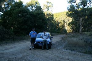
Psud (Adam) and Chris decided that -35, 149 was too close and too easy. Not to mention being in the middle of some farmer's property. So we decided on -35, 148. An easy trip to the Brindabella Ranges, and 1300m from the road.
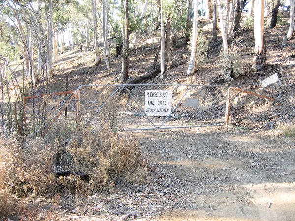
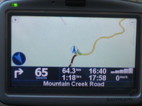
The location was programmed into three GPSs, a car navigating one, a less clever one that doesn't think you should be on a road, and a mobile phone. The car GPS took us down road after road, each one more rutted and rocky than the previous. We opened gates, dodged boulders, and made our way to an erosion gully we couldn't cross.
We went back.
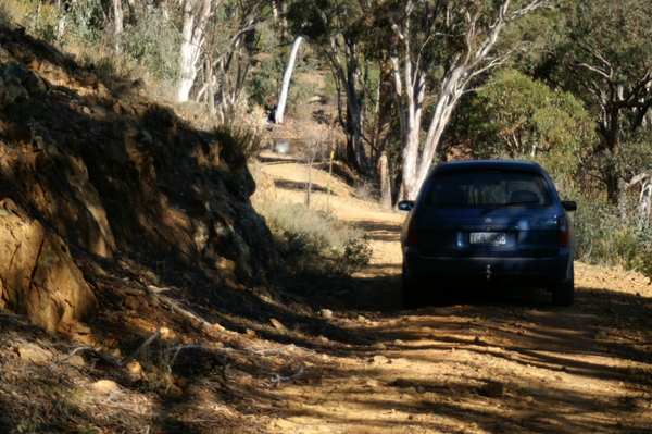
We tried another way - we had to drive on a bit of road that the GPS wouldn't believe was there. It was paved too. It was looking good. We got within 20km of the point and considered walking from there. We decided to carry on by car - Google Maps had shown a rather simple drive that looked like it should be on fairly major outback roads - the car GPS showed a way that was all on yellow-coloured roads (map speak for "Major road").
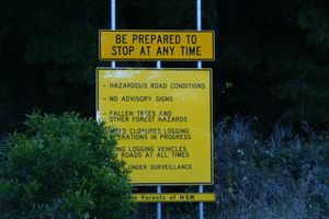
We dodged cows, sheep and four wheel drive vehicles. We reached gravel road. Dirt road. Then we came to a sign. It was past 4:00. The sign clinched it. So we didn't make it. But I'm sure there was an easier way. Google maps showed what I'm sure was a different way to go.
Moral of the story: Check paper maps before you leave.
We didn't get a chance to play dominoes.
Oh, and yes, there was an easier way. Google maps shows it. Thank Ghu for Google. Psud will try again tomorrow.
Actually he won't. When calculated correctly - with Sunday's date and the most recent Dow price, all nearby spots are not much good, so Psud's going to brew beer instead. Beer is to be bottled in preparation for the first occasion when the spot lands in Canberra or her suburbs.
