Difference between revisions of "2011-08-28 55 -2"
imported>Reinhard (gallery) |
imported>FippeBot m (Location) |
||
| (5 intermediate revisions by one other user not shown) | |||
| Line 14: | Line 14: | ||
== Expedition == | == Expedition == | ||
| + | |||
| + | In the morning, Manu and Reinhard arrived with their car in Newcastle after an over-night ferry trip from Amsterdam. Being on holidays for one week in Scotland, there first destination was Hadrian's Wall, before they continued to Edinburgh. The hashpoint was just one kilometer from the road they took, so they at least had to try to get there. | ||
| + | |||
| + | As the satellite view already showed, there were lots of small walls between the fields, but there were also gates, which weren't locked, but only closed. It was not clear from which point of the road they should start walking, but it quickly got clear, that the first point they chose (the parking lot of Otterburn Mill) wasn't the best, since it was on the wrong side of a river, which wasn't likely to cross without a boat. So they drove back few kilometers from where they came and tried it from the other side. A small parking lot was located conveniently close and from there they started a long sequence of fence crossing. First meadow was inhabited by cows and sheep, which peacefully ran to the other edge of their area, when the geo intruders came. It's not known how many further gates had to be opened and closed (with the area around the gates always very muddy), until the hashers finally got onto the hash field, which was inhabited by sheep, but it's known that the hashers reached the coordinates of their first geohash in Great Britain. Altogether, they walked about 3 km. | ||
| + | |||
| + | The hashers noticed, that they could see Otterburn Mill, from where they did their first attempt to reach the point, from the hashpoint, and they knew that there was a restaurant, so they decided to have lunch there, before continuing their journey. It wasn't yet the right time of the day for alcoholic beverages, so Manu and Reinhard sticked to some refreshments, but believe that is also sufficient for getting the pub achievement. | ||
== Photos == | == Photos == | ||
| Line 24: | Line 30: | ||
|Image:20110828-55N2W-06.jpg|There we are. | |Image:20110828-55N2W-06.jpg|There we are. | ||
|Image:20110828-55N2W-07.jpg|Hash view to Otterburn. | |Image:20110828-55N2W-07.jpg|Hash view to Otterburn. | ||
| + | |Image:20110828-55N2W-07a.JPG|View to the "pub". | ||
|Image:20110828-55N2W-08.jpg|Hash sheep. | |Image:20110828-55N2W-08.jpg|Hash sheep. | ||
|Image:20110828-55N2W-09.jpg|Hasher pointing at hash point. | |Image:20110828-55N2W-09.jpg|Hasher pointing at hash point. | ||
|Image:20110828-55N2W-10.jpg|At the "pub". | |Image:20110828-55N2W-10.jpg|At the "pub". | ||
| − | |Image:20110828-55N2W-11.jpg|Pub with hasher pointing at hash point. | + | |Image:20110828-55N2W-11.jpg|"Pub" with hasher pointing at hash point. |
}} | }} | ||
| − | |||
== Achievements == | == Achievements == | ||
| − | + | {{pub geohash | latitude = 55 | longitude = -2 | date = 2011-08-28 | name = Manu and Reinhard | image = 20110828-55N2W-10.jpg}} | |
[[Category:Expeditions]] | [[Category:Expeditions]] | ||
[[Category:Expeditions with photos]] | [[Category:Expeditions with photos]] | ||
[[Category:Coordinates reached]] | [[Category:Coordinates reached]] | ||
| + | {{location|GB|ENG|NBL}} | ||
Latest revision as of 00:40, 13 August 2019
| Sun 28 Aug 2011 in 55,-2: 55.2265003, -2.1970353 geohashing.info google osm bing/os kml crox |
Location
On a meadow near Otterburn in North England.
Participants
Expedition
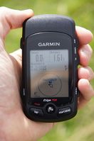
In the morning, Manu and Reinhard arrived with their car in Newcastle after an over-night ferry trip from Amsterdam. Being on holidays for one week in Scotland, there first destination was Hadrian's Wall, before they continued to Edinburgh. The hashpoint was just one kilometer from the road they took, so they at least had to try to get there.
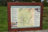
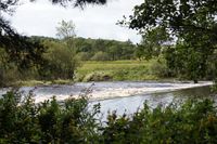
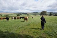
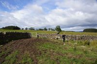
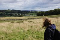
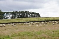
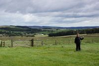
As the satellite view already showed, there were lots of small walls between the fields, but there were also gates, which weren't locked, but only closed. It was not clear from which point of the road they should start walking, but it quickly got clear, that the first point they chose (the parking lot of Otterburn Mill) wasn't the best, since it was on the wrong side of a river, which wasn't likely to cross without a boat. So they drove back few kilometers from where they came and tried it from the other side. A small parking lot was located conveniently close and from there they started a long sequence of fence crossing. First meadow was inhabited by cows and sheep, which peacefully ran to the other edge of their area, when the geo intruders came. It's not known how many further gates had to be opened and closed (with the area around the gates always very muddy), until the hashers finally got onto the hash field, which was inhabited by sheep, but it's known that the hashers reached the coordinates of their first geohash in Great Britain. Altogether, they walked about 3 km.
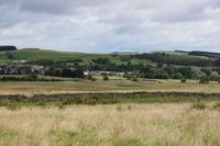
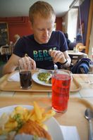
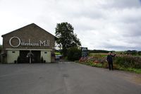
The hashers noticed, that they could see Otterburn Mill, from where they did their first attempt to reach the point, from the hashpoint, and they knew that there was a restaurant, so they decided to have lunch there, before continuing their journey. It wasn't yet the right time of the day for alcoholic beverages, so Manu and Reinhard sticked to some refreshments, but believe that is also sufficient for getting the pub achievement.
Photos
|
Achievements
Manu and Reinhard earned the Pub Geohash Achievement
|
