Difference between revisions of "2011-08-29 44 -106"
imported>FippeBot m (Location) |
m (per Renaming Proposal) |
||
| Line 53: | Line 53: | ||
}} | }} | ||
| − | {{ | + | {{Graticule unlocked |
| latitude = 44 | | latitude = 44 | ||
| longitude = -106 | | longitude = -106 | ||
Latest revision as of 05:50, 20 March 2024

| Mon 29 Aug 2011 in 44,-106: 44.3297455, -106.9905078 geohashing.info google osm bing/os kml crox |
Location
One mile off the road, a quarter mile off the trail, down on the side of a somewhat steep hill.
Participants
- tankgunk
- his sister.
Plans
Drove down to Buffalo and into the forest, left Sheridan a bit after 3:30pm.
Expedition
Drove to the trail head and went on a ~1 mile hike to the point. More hiking than I generally appreciate, but pretty straightforward. My sister wore PJs and flip flops for the expedition...didn't phase her, but I probably would have said something if I had noticed earlier.
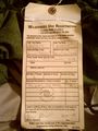
Forgot the camera, and I was using my phone as a GPS, so I couldn't get the usual proof, the registration and trailhead sign photos should be sufficient.
Photos
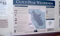
Regulations and such at the trail head, which is what I can manage for proof.
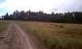
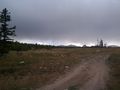
Heading up the trail...
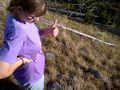
Yes, she wore PJs and flip flops for a 2 mile hike.
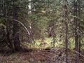
Ohai trees.
Rained on us a tiny bit, nothing too awesome.
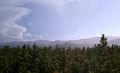
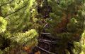
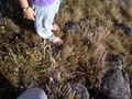
Between the trail and the point was an impressively thick field of young trees.
Don't worry, we were nice to the baby trees. They're cute : )
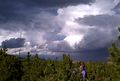
Rainbow! Told you there was rain ^_^ Favorite picture from the day.
~300 more feet of this : /
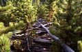
We took the long way and went around this crap on the way back...
Finally on the other side of the tiny trees. Woo.
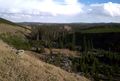
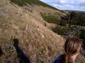
The hash point is on the side of this hill.
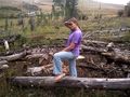
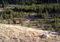
Point reached.
Yup.
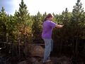
Standing around on the hill.
More proof, shame I couldn't get a picture of the GPS.


Achievements
tankgunk earned the Land geohash achievement
|
tankgunk earned the Graticule Unlocked Achievement
|
tankgunk earned the Star photographer achievement
|