Difference between revisions of "2011-12-16 51 11"
From Geohashing
imported>Reinhard (not ready, yet) |
imported>FippeBot m (Location) |
||
| (4 intermediate revisions by one other user not shown) | |||
| Line 13: | Line 13: | ||
== Expedition == | == Expedition == | ||
| − | After visiting the [[2011-12-15_51_11|preceding hash in this graticule]] I had 50 minutes to reach this one for the Midnight achievement, which I already owned. ... | + | After visiting the [[2011-12-15_51_11|preceding hash in this graticule]] I had 50 minutes to reach this one for the Midnight achievement, which I already owned. With 22 km to ride this should be possible. It was, since I arrived 5 minutes in time. So I ate two cereal bars, before the hashpoint came to me. It was on or next to a narrow path which is even recorded in OSM. As I didn't want to come home too late, I quickly rode on after taking the necessary photos. I rode uphill to Bergsulza and from there on was faced with a considerable head wind while my power was fading constantly. With a ridiculous average speed I finally reached home and Jena after 71 km (also making this a TRON expedition) around 1:15 a.m. |
== Photos == | == Photos == | ||
| Line 27: | Line 27: | ||
{{Bicycle geohash | latitude=51 | longitude=11 | date=2011-12-16 | name=Reinhard}} | {{Bicycle geohash | latitude=51 | longitude=11 | date=2011-12-16 | name=Reinhard}} | ||
{{Midnight geohash | latitude = 51 | longitude = 11 | date = 2011-12-16 | name = Reinhard}} | {{Midnight geohash | latitude = 51 | longitude = 11 | date = 2011-12-16 | name = Reinhard}} | ||
| − | {{consecutive geohash | count=2 | latitude=51 | longitude=11 | date=2011-12- | + | {{consecutive geohash | count=2 | latitude=51 | longitude=11 | date=2011-12-15 | name=Reinhard }} |
{{Tron | latitude = 51 | longitude = 11 | date = 2011-12-16 | name = Reinhard | possessive = his}} | {{Tron | latitude = 51 | longitude = 11 | date = 2011-12-16 | name = Reinhard | possessive = his}} | ||
| Line 35: | Line 35: | ||
[[Category:Expeditions with photos]] | [[Category:Expeditions with photos]] | ||
[[Category:Coordinates reached]] | [[Category:Coordinates reached]] | ||
| + | {{location|DE|TH|AP}} | ||
Latest revision as of 01:45, 13 August 2019
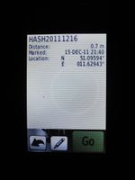
| Fri 16 Dec 2011 in 51,11: 51.0959374, 11.6294291 geohashing.info google osm bing/os kml crox |
Location
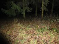
Between trees in Bad Sulza (Thuringia).
Participants
Expedition
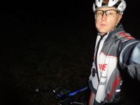
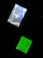
After visiting the preceding hash in this graticule I had 50 minutes to reach this one for the Midnight achievement, which I already owned. With 22 km to ride this should be possible. It was, since I arrived 5 minutes in time. So I ate two cereal bars, before the hashpoint came to me. It was on or next to a narrow path which is even recorded in OSM. As I didn't want to come home too late, I quickly rode on after taking the necessary photos. I rode uphill to Bergsulza and from there on was faced with a considerable head wind while my power was fading constantly. With a ridiculous average speed I finally reached home and Jena after 71 km (also making this a TRON expedition) around 1:15 a.m.
Photos
|
Achievements
Reinhard earned the Land geohash achievement
|
Reinhard earned the Bicycle geohash achievement
|
Reinhard earned the Midnight Geohash achievement
|
Reinhard earned the Consecutive geohash achievement
|
Reinhard earned the Tron achievement
|


