Difference between revisions of "2012-02-05 50 8"
From Geohashing
imported>Mampfred m (+Tracklog) |
imported>FippeBot m (Location) |
||
| (One intermediate revision by one other user not shown) | |||
| Line 28: | Line 28: | ||
== Photos == | == Photos == | ||
| − | |||
<gallery perrow="5"> | <gallery perrow="5"> | ||
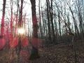
| − | Image:2012-02-05_50_8_15-24-54-438.jpg | | + | Image:2012-02-05_50_8_sunny_but_cold.jpg | Great weather. Cold but sunny. |
| + | Image:2012-02-05_50_8_up_the_mountain.jpg | Heading up the mountain. | ||
| + | Image:2012-02-05_50_8_hash_horses.jpg | Hash horses along the way. | ||
| + | Image:2012-02-05_50_8_still_going_up_run_forest.jpg | Still going up, come on already ... | ||
| + | Image:2012-02-05_50_8_entering_the_woods.jpg | Entering the woods. | ||
| + | Image:2012-02-05_50_8_coordinates_reached.jpg | Coordinates reached. | ||
| + | Image:2012-02-05_50_8_15-24-54-438.jpg | Hash grin @ -5°C | ||
| + | Image:2012-02-05_50_8_sun_setting_on_the_way_back.jpg | Sun's setting, let's head back. | ||
| + | Image:2012-02-05_50_8_shadow_hashing.jpg | Hash shadows. | ||
</gallery> | </gallery> | ||
| Line 41: | Line 48: | ||
[[Category:Expeditions with photos]] | [[Category:Expeditions with photos]] | ||
[[Category:Coordinates reached]] | [[Category:Coordinates reached]] | ||
| + | {{location|DE|HE|SWA}} | ||
Latest revision as of 02:19, 13 August 2019
| Sun 5 Feb 2012 in 50,8: 50.0592770, 8.1379030 geohashing.info google osm bing/os kml crox |
Location
In the forest behind Wiesbaden Frauenstein.
Participants
Plans
Go there for a nice afternoon walk.
Expedition
Mampfred, LadyBB and EmmJay picked up the rest of the gang and we drove most of the way to Frauenstein. Found a sunny spot to park the car and started walking up and down the valleys.
The hash was easily found in the middle of the forest. Due to the good weather there were a lot more dog walkers than usual, even some that passed the hash by a few meters in front of us.
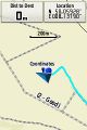
Tracklog
See here.
Photos
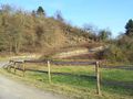
Great weather. Cold but sunny.
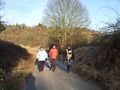
Heading up the mountain.
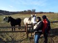
Hash horses along the way.
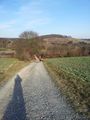
Still going up, come on already ...
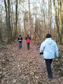
Entering the woods.
Coordinates reached.

Hash grin @ -5°C
Sun's setting, let's head back.
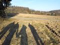
Hash shadows.


Achievements
- Land
- Frozen