Difference between revisions of "2012-02-29 42 -88"
imported>Robyn (Just use the whole numbers for lat long of the graticule. That way the categories and map come out right.) |
imported>FippeBot m (Location) |
||
| (7 intermediate revisions by 2 users not shown) | |||
| Line 14: | Line 14: | ||
}} | }} | ||
| − | + | ||
__NOTOC__ | __NOTOC__ | ||
== Location == | == Location == | ||
| − | + | ||
Field outside of Volo, IL. | Field outside of Volo, IL. | ||
| − | + | Google maps lists nearest address as 30981 N Fisher Rd, Wauconda, IL 60084. Appears to be in a farmer's field very close to an access road. | |
== Participants == | == Participants == | ||
| − | + | ||
| − | [[User:FireTrophy|FireTrophy]]. This is my first attempt at a geohash! | + | * [[User:FireTrophy|FireTrophy]]. This is my first attempt at a geohash! |
== Plans == | == Plans == | ||
| − | + | ||
Planning to drive out there, to arrive around ~7:30 pm. | Planning to drive out there, to arrive around ~7:30 pm. | ||
| + | |||
Gonna grab some dinner later, there looks to be a place called [http://maps.google.com/maps/place?cid=9718501833782331157&q=restaurant&hl=en&authuser=0&cd=3&cad=src:ppiwlink&ei=iLZOT4OmLpGN_AamsfHlBw&dtab=2 Bobby's Barrel Inn] nearby. | Gonna grab some dinner later, there looks to be a place called [http://maps.google.com/maps/place?cid=9718501833782331157&q=restaurant&hl=en&authuser=0&cd=3&cad=src:ppiwlink&ei=iLZOT4OmLpGN_AamsfHlBw&dtab=2 Bobby's Barrel Inn] nearby. | ||
== Expedition == | == Expedition == | ||
| − | |||
| − | + | After speaking with a very polite but confused Farmer Mike, I received his permission to walk out to his cornfield around 7:20 CST. I don't have a GPS, so I used Google Earth instead. But I couldn't get the tool to report my exact GPS setting. So I estimated where I thought it would be, according to what I looked up earlier. The ground out there was soft and loamy, due to a very mild winter. The weather was kind of cold that night though, and the wind cut quite deeply. I marked the spot with a little note in the dirt explaining the idea of geohashing and a link to the wiki page. | |
| − | + | Then I stopped at the local tavern, where they were having a fish fry night. Good stuff. | |
| − | + | I realize now after the fact that the actual spot was like 200ft to the SE. I still count this as a win, though. | |
| + | |||
| + | Notes for future expeditions: bring change of shoes. That mud gets everywhere. Also, might be a good idea to bring a reflective vest, just to be more visible and avoid any suspicion. | ||
| − | |||
| − | |||
| − | |||
| − | |||
== Photos == | == Photos == | ||
| − | + | ||
| − | |||
| − | |||
<gallery perrow="5"> | <gallery perrow="5"> | ||
| + | Image:2012-02-29_42_-88_1-OnTheWay.JPG | On the way! | ||
| + | Image:2012-02-29_42_-88_2-ImThere.JPG | I'm there | ||
| + | Image:2012-02-29_42_-88_3-FieldView.JPG | Pleasant, loamy soil at site. | ||
| + | Image:2012-02-29_42_-88_4-FromTheInternet.JPG | Left note. Don't worry ma'am, we're from the internet. | ||
| + | Image:2012-02-29_42_-88_5-GPSApproximation.JPG | Google Earth - shot from camera | ||
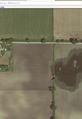
| + | Image:2012-02-29_42_-88_6-GoogleEarth.PNG | Google Earth - screenshot | ||
| + | Image:2012-02-29_42_-88_7-Tavern.JPG | Beer time! Local tavern. | ||
| + | Image:2012-02-29_42_-88_8-Tavern.JPG | Beer + Fish Fry, delicious. | ||
| + | Image:2012-02-29_42_-88_9-WhereIShouldHaveBeen.jpg | Where I should have been. | ||
</gallery> | </gallery> | ||
| Line 58: | Line 63: | ||
<!-- Add any achievement ribbons you earned below, or remove this section --> | <!-- Add any achievement ribbons you earned below, or remove this section --> | ||
| + | * Land Geohash | ||
| − | |||
| − | |||
| − | |||
| − | |||
| − | |||
| − | |||
| − | |||
| − | |||
| − | |||
[[Category:Expeditions]] | [[Category:Expeditions]] | ||
| − | |||
[[Category:Expeditions with photos]] | [[Category:Expeditions with photos]] | ||
| − | + | ||
[[Category:Expedition without GPS]] | [[Category:Expedition without GPS]] | ||
| − | + | ||
| − | |||
| − | |||
[[Category:Coordinates reached]] | [[Category:Coordinates reached]] | ||
| − | + | {{location|US|IL|LK}} | |
| − | |||
| − | |||
| − | |||
| − | |||
| − | |||
| − | |||
| − | |||
| − | |||
| − | |||
Latest revision as of 02:35, 13 August 2019
| Wed 29 Feb 2012 in 42,-88: 42.3129303, -88.1794689 geohashing.info google osm bing/os kml crox |
Location
Field outside of Volo, IL.
Google maps lists nearest address as 30981 N Fisher Rd, Wauconda, IL 60084. Appears to be in a farmer's field very close to an access road.
Participants
- FireTrophy. This is my first attempt at a geohash!
Plans
Planning to drive out there, to arrive around ~7:30 pm.
Gonna grab some dinner later, there looks to be a place called Bobby's Barrel Inn nearby.
Expedition
After speaking with a very polite but confused Farmer Mike, I received his permission to walk out to his cornfield around 7:20 CST. I don't have a GPS, so I used Google Earth instead. But I couldn't get the tool to report my exact GPS setting. So I estimated where I thought it would be, according to what I looked up earlier. The ground out there was soft and loamy, due to a very mild winter. The weather was kind of cold that night though, and the wind cut quite deeply. I marked the spot with a little note in the dirt explaining the idea of geohashing and a link to the wiki page.
Then I stopped at the local tavern, where they were having a fish fry night. Good stuff.
I realize now after the fact that the actual spot was like 200ft to the SE. I still count this as a win, though.
Notes for future expeditions: bring change of shoes. That mud gets everywhere. Also, might be a good idea to bring a reflective vest, just to be more visible and avoid any suspicion.
Photos
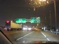
On the way!
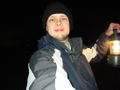
I'm there
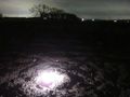
Pleasant, loamy soil at site.
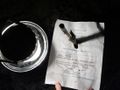
Left note. Don't worry ma'am, we're from the internet.
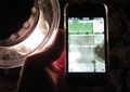
Google Earth - shot from camera
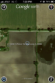
Google Earth - screenshot
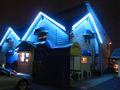
Beer time! Local tavern.
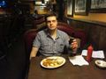
Beer + Fish Fry, delicious.
Where I should have been.


Achievements
- Land Geohash