Difference between revisions of "2012-03-09 49 8"
imported>Rincewind (→Expedition) |
imported>FippeBot m (Location) |
||
| (8 intermediate revisions by 3 users not shown) | |||
| Line 14: | Line 14: | ||
}} | }} | ||
| − | |||
__NOTOC__ | __NOTOC__ | ||
== Location == | == Location == | ||
| − | |||
Next to a rail track in Worms. | Next to a rail track in Worms. | ||
== Participants == | == Participants == | ||
| − | + | * [[user:Rincewind | Rincewind]] | |
| − | [[user:Rincewind | Rincewind]] | + | * [[User:Yakamoz|Yakamoz]] |
== Plans == | == Plans == | ||
| − | + | [[user:Rincewind | Rincewind]] will attempt to reach the hash after picking up [[User:Yakamoz|Yakamoz]] on the way home, thus making it a multihash, hopefully. | |
| − | [[user:Rincewind | Rincewind]] will attempt to reach the hash after picking up | ||
Afterwards he'll have to document all pending expeditions, in order not to get annoyed too often by Mampfred, him being an impatient hasher of the worst sort. | Afterwards he'll have to document all pending expeditions, in order not to get annoyed too often by Mampfred, him being an impatient hasher of the worst sort. | ||
| Line 33: | Line 30: | ||
== Expedition == | == Expedition == | ||
| − | We went to Worms and parked in front of a sports club house | + | We went to Worms and parked in front of a sports club house about hundred meters from the rail track. |
We walked along the street parallel to the track, but after 150m it got clear that the hash was on the other side of the track- separated by sound proofing walls. Accordingly, we turned around, took the pedestrian underpass and walked along a field path. 200m on we reached the hash point, right on the border to the rail track in some thorny bushes. Yay! | We walked along the street parallel to the track, but after 150m it got clear that the hash was on the other side of the track- separated by sound proofing walls. Accordingly, we turned around, took the pedestrian underpass and walked along a field path. 200m on we reached the hash point, right on the border to the rail track in some thorny bushes. Yay! | ||
| − | + | And a double hash, at that- double-yay! | |
| − | |||
== Photos == | == Photos == | ||
| − | |||
| − | |||
| − | |||
<gallery perrow="5"> | <gallery perrow="5"> | ||
| + | Image:Hashgrin_worms.jpg | Actually, that moon was quite bright when not just using a photo flash. | ||
| + | Image:Worms-proof 2012-03-09.jpg | Got there. | ||
</gallery> | </gallery> | ||
== Achievements == | == Achievements == | ||
| − | {{ | + | {{Multihash |
| − | + | | latitude1 = 50 | |
| + | | longitude1 = 9 | ||
| + | | latitude2 = 49 | ||
| + | | longitude2 = 8 | ||
| + | | date = 2012-03-09 | ||
| + | | name = [[user:Rincewind | Rincewind]] aborted the attempt to reach the 50, 8 hash of the day and still | ||
| + | }} | ||
| + | * Land geohash | ||
| − | |||
| − | |||
| − | |||
| − | |||
| − | |||
| − | |||
| − | |||
| − | |||
| − | |||
| − | |||
[[Category:Expeditions]] | [[Category:Expeditions]] | ||
| − | |||
[[Category:Expeditions with photos]] | [[Category:Expeditions with photos]] | ||
| − | |||
| − | |||
| − | |||
| − | |||
| − | |||
[[Category:Coordinates reached]] | [[Category:Coordinates reached]] | ||
| − | + | {{location|DE|RP|WO}} | |
| − | |||
| − | |||
| − | |||
| − | |||
| − | |||
| − | |||
| − | |||
| − | |||
| − | |||
Latest revision as of 02:48, 13 August 2019
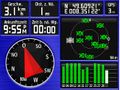
| Fri 9 Mar 2012 in 49,8: 49.6092115, 8.3512291 geohashing.info google osm bing/os kml crox |
Location
Next to a rail track in Worms.
Participants
Plans
Rincewind will attempt to reach the hash after picking up Yakamoz on the way home, thus making it a multihash, hopefully.
Afterwards he'll have to document all pending expeditions, in order not to get annoyed too often by Mampfred, him being an impatient hasher of the worst sort. That had to be said by a half-ninja.
- *grrrrr* ... *woof* *woof* ... *grrrrrrrr* - Mampfred 08:58, 9 March 2012 (EST)
Expedition
We went to Worms and parked in front of a sports club house about hundred meters from the rail track. We walked along the street parallel to the track, but after 150m it got clear that the hash was on the other side of the track- separated by sound proofing walls. Accordingly, we turned around, took the pedestrian underpass and walked along a field path. 200m on we reached the hash point, right on the border to the rail track in some thorny bushes. Yay!
And a double hash, at that- double-yay!
Photos

Actually, that moon was quite bright when not just using a photo flash.
Got there.


Achievements
Rincewind aborted the attempt to reach the 50, 8 hash of the day and still earned the Multihash Achievement
|
- Land geohash