Difference between revisions of "2012-03-09 50 9"
From Geohashing
imported>Rincewind |
imported>FippeBot m (Location) |
||
| (2 intermediate revisions by 2 users not shown) | |||
| Line 10: | Line 10: | ||
== Participants == | == Participants == | ||
| − | [[ | + | * [[User:Rincewind|Rincewind]] |
== Plans == | == Plans == | ||
| − | After planning to do the [[2012-03-09_49_8|49 8]] and [[2012-03- | + | After planning to do the [[2012-03-09_49_8|49 8]] and [[2012-03-09_50_8|50 8]] hashes, I thought I could just maybe attempt the 50 9 as well, and on the map it didn't look to far off track... |
Well. Let's try... | Well. Let's try... | ||
| Line 25: | Line 25: | ||
Image:Lauterbach-proof_2012-03-09.jpg | Didn't get a 0m-shot. :-/ | Image:Lauterbach-proof_2012-03-09.jpg | Didn't get a 0m-shot. :-/ | ||
</gallery> | </gallery> | ||
| + | |||
| + | |||
[[Category:Expeditions]] | [[Category:Expeditions]] | ||
[[Category:Expeditions with photos]] | [[Category:Expeditions with photos]] | ||
[[Category:Coordinates reached]] | [[Category:Coordinates reached]] | ||
| − | + | {{location|DE|HE|VB}} | |
| − | |||
Latest revision as of 02:49, 13 August 2019
| Fri 9 Mar 2012 in 50,9: 50.6092115, 9.3512291 geohashing.info google osm bing/os kml crox |
Location
In a residential area in Lauterbach/Frischborn
Participants
Plans
After planning to do the 49 8 and 50 8 hashes, I thought I could just maybe attempt the 50 9 as well, and on the map it didn't look to far off track... Well. Let's try...
Expedition
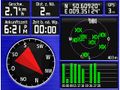
I let the TomTom guide me to the address given on Active Geohasher and activated the outdoor GPS just before arriving there. Within accuracy, it seems I even parked on the spot, yet I couldn't get anything less than 3m, even with much climbing through thorny bushes next to the car. Make that 2m.
Photos

Me and the car standing more or less directly on the coordinates.
Didn't get a 0m-shot. :-/

