Difference between revisions of "2012-05-15 53 6"
imported>Elwingelfje (Created page with "{{subst:Expedition |lat = 53 |lon = 6 |date = 2012-05-15 }}") |
m (per Renaming Proposal) |
||
| (7 intermediate revisions by 2 users not shown) | |||
| Line 1: | Line 1: | ||
| − | |||
<!-- If you did not specify these parameters in the template, please substitute appropriate values for IMAGE, LAT, LON, and DATE (YYYY-MM-DD format) | <!-- If you did not specify these parameters in the template, please substitute appropriate values for IMAGE, LAT, LON, and DATE (YYYY-MM-DD format) | ||
| Line 13: | Line 12: | ||
__NOTOC__ | __NOTOC__ | ||
== Location == | == Location == | ||
| − | + | Lettelbert | |
== Participants == | == Participants == | ||
| − | + | [[User:Elwingelfje|Elwingelfje]] | |
| − | |||
== Plans == | == Plans == | ||
| − | + | Go there by bike. Hope the hash isn't too inaccessible as it's in the middle of an agricultural area. And hope the farmer has no aggressive dogs. | |
== Expedition == | == Expedition == | ||
| − | |||
| − | + | I left around 11 o'clock, by bike. The first part went quite well. Some light drizzle, but nothing I couldn't handle. I spotted some Dutch Belted cows, a traditional race from this area. Having cycled about 4 km, I arrived in a nature area called "de Onlanden", a treeless watery landscape. Unfortunately this was also where the rain intensified. I regretted not packing waterproof pants. A passing cyclist alerted me to a spoonbill in one of the lakes, quite a rare bird and, according to him, something he had never seen in this place before (he went there every day). I thought this was quite cool. | |
| − | + | ||
| + | This was where the trouble with the road started. I don't know how many detours and trackbacks I made, but they were too many. I used a combination of paper map and road signs that didn't work very well. In the end I found the right route again; by then I had cycled at least 15 km and I was very wet and quite tired. I also saw a pair of stork in flight. | ||
| + | |||
| + | I rounded the tip of the Leekstermeer (having cycled south of it) and found the little forest near the hashpoint. Excitement! There was even a path in the forest. Not used very often, but it was very clearly a path. At some point the way was blocked by a fallen tree, I climbed over it. In the back of the forest the path had become a very narrow track flanked by knee-high stinging nettles on both sides. I reached the tip of the forest most near the hashpoint (which itself was located on a meadow). The 4 things I would have to cross to reach it were: 1) shoulder-high brambles and stinging nettles 2) a fence, possibly electrified 3) a ditch 4) a herd of about 20 cows. At this point I decided to call it a day and cycle back (along a slightly more straightforward route). | ||
== Photos == | == Photos == | ||
| − | + | ||
| − | |||
| − | |||
<gallery perrow="5"> | <gallery perrow="5"> | ||
| + | Image:2012-05-16 53 6 bike.JPG | My bicycle (with map and signpost) | ||
| + | Image:2012-05-16 53 6 dead end.JPG | One of the dead ends I accidentally took. Also local landscape and OMINOUS DARK RAINCLOUDS OMG | ||
| + | Image:2012-05-16 53 6 spoonbill.JPG | You'll just have to believe me in that that white dot in the middle of the picture is a spoonbill. | ||
| + | Image:2012-05-16 53 6 obstacle.JPG | I climbed over this. Oh yeah. | ||
| + | Image:2012-05-16 53 6 me.JPG | Proof that I got really very wet. | ||
| + | Image:2012-05-16 53 6 nettles.JPG | Proof that my pants also got wet and that there were nettles. | ||
| + | Image:2012-05-16 53 6 mnb.JPG | And... thwarted. D: | ||
| + | Image:2012-05-16 53 6 canal.JPG | Random sign on the way back that I found peculiar. (It says "Very dangerous! Canal crosses high-voltage cable. Max height of ship 30 m".) | ||
</gallery> | </gallery> | ||
== Achievements == | == Achievements == | ||
{{#vardefine:ribbonwidth|800px}} | {{#vardefine:ribbonwidth|800px}} | ||
| − | + | {{done with nature | |
| + | | latitude = 53 | ||
| + | | longitude = 6 | ||
| + | | date = 2012-05-15 | ||
| + | | name = elwingelfje | ||
| + | }} | ||
| − | + | [[Category:Expeditions]] | |
| − | |||
| − | [[Category: | ||
| − | |||
| − | |||
| − | |||
| − | |||
| − | |||
| − | |||
<!-- An actual expedition: | <!-- An actual expedition: | ||
| − | |||
-- and one or more of -- | -- and one or more of -- | ||
[[Category:Expeditions with photos]] | [[Category:Expeditions with photos]] | ||
[[Category:Expeditions with videos]] | [[Category:Expeditions with videos]] | ||
[[Category:Expedition without GPS]] | [[Category:Expedition without GPS]] | ||
| − | |||
| − | |||
| − | |||
| − | |||
--> | --> | ||
| − | |||
[[Category:Coordinates not reached]] | [[Category:Coordinates not reached]] | ||
| − | + | [[Category:Not reached - Mother Nature]] | |
| − | [[Category:Not reached - Mother Nature]] | + | {{location|NL|GR}} |
| − | |||
| − | |||
| − | |||
| − | |||
Latest revision as of 14:36, 2 April 2024
| Tue 15 May 2012 in 53,6: 53.1853632, 6.4111400 geohashing.info google osm bing/os kml crox |
Location
Lettelbert
Participants
Plans
Go there by bike. Hope the hash isn't too inaccessible as it's in the middle of an agricultural area. And hope the farmer has no aggressive dogs.
Expedition
I left around 11 o'clock, by bike. The first part went quite well. Some light drizzle, but nothing I couldn't handle. I spotted some Dutch Belted cows, a traditional race from this area. Having cycled about 4 km, I arrived in a nature area called "de Onlanden", a treeless watery landscape. Unfortunately this was also where the rain intensified. I regretted not packing waterproof pants. A passing cyclist alerted me to a spoonbill in one of the lakes, quite a rare bird and, according to him, something he had never seen in this place before (he went there every day). I thought this was quite cool.
This was where the trouble with the road started. I don't know how many detours and trackbacks I made, but they were too many. I used a combination of paper map and road signs that didn't work very well. In the end I found the right route again; by then I had cycled at least 15 km and I was very wet and quite tired. I also saw a pair of stork in flight.
I rounded the tip of the Leekstermeer (having cycled south of it) and found the little forest near the hashpoint. Excitement! There was even a path in the forest. Not used very often, but it was very clearly a path. At some point the way was blocked by a fallen tree, I climbed over it. In the back of the forest the path had become a very narrow track flanked by knee-high stinging nettles on both sides. I reached the tip of the forest most near the hashpoint (which itself was located on a meadow). The 4 things I would have to cross to reach it were: 1) shoulder-high brambles and stinging nettles 2) a fence, possibly electrified 3) a ditch 4) a herd of about 20 cows. At this point I decided to call it a day and cycle back (along a slightly more straightforward route).
Photos
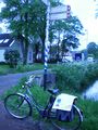
My bicycle (with map and signpost)
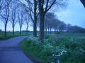
One of the dead ends I accidentally took. Also local landscape and OMINOUS DARK RAINCLOUDS OMG
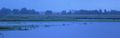
You'll just have to believe me in that that white dot in the middle of the picture is a spoonbill.
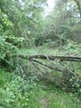
I climbed over this. Oh yeah.
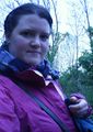
Proof that I got really very wet.
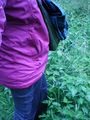
Proof that my pants also got wet and that there were nettles.
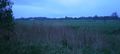
And... thwarted. D:
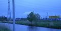
Random sign on the way back that I found peculiar. (It says "Very dangerous! Canal crosses high-voltage cable. Max height of ship 30 m".)


Achievements
elwingelfje earned the Done with Nature consolation prize
|