Difference between revisions of "2012-06-08 27 -82"
imported>DrCanadianNinja |
m |
||
| (One intermediate revision by one other user not shown) | |||
| Line 15: | Line 15: | ||
=== The Geohashers === | === The Geohashers === | ||
| − | * [[user: | + | * [[user:Geoffistopheles|Geoff]] |
* [[user:NinjaBait|Erica]] | * [[user:NinjaBait|Erica]] | ||
| Line 42: | Line 42: | ||
| longitude = -81 | | longitude = -81 | ||
| date = 2012-06-07 | | date = 2012-06-07 | ||
| − | | name = [[user: | + | | name = [[user:Geoffistopheles|Geoff]] |
}} | }} | ||
{{Multihash2 | {{Multihash2 | ||
| count = 2 | | count = 2 | ||
| date = 2012-06-08 | | date = 2012-06-08 | ||
| − | | name = [[user: | + | | name = [[user:Geoffistopheles|Geoff]] |
}} | }} | ||
| Line 55: | Line 55: | ||
[[Category:Meetup on 2012-06-08]] | [[Category:Meetup on 2012-06-08]] | ||
[[Category:Meetup in 27 -82]] | [[Category:Meetup in 27 -82]] | ||
| + | {{location|US|FL|HL}} | ||
Latest revision as of 16:59, 24 March 2021
| Have you seen our geohashing marker? We'd love to hear from you! Click here to say "hi" and tell us what you've seen!
Curious about what geohashing is? Read more! |
| Fri 8 Jun 2012 in Tampa, Florida: 27.9102003, -82.4203043 geohashing.info google osm bing/os kml crox |
Expedition
The Plan
In a trainyard in Port of Tampa.
The Geohashers
The Adventure
After our first hash in Citrus Hills, we slowly got back on I-75 to head down to the Tampa hash. We weren't driving more than five minutes before the rain caught up to us and starting pouring again. Now, I'm more familiar with the Tampa side of the previous graticule, so this was a slightly odd choice of routes. Typically, I would follow I-75 down until it branches into I-275, then follow that. University of South Florida, my terrible alma mater, is off this highway, which then connects with I-4 in the heart of Tampa. Rather than take 275 to that junction, hit 4 west and turn off when ready, we stayed on 75 until it intersected 4, got on 4 east and jumped off within minutes. A simple plan, but one that argued against every route I drove there for years.
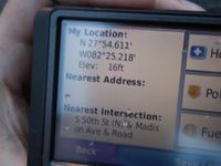
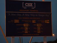
Off the road, we took FL-40 south, past the toll road, and then started the GPS actively screwing with us. When I checked Google Maps, the plan was to turn off onto a side street which met Rockport Road, which took us all the way down to the train terminal. Instead, the GPS took us further down the road to Fort Sutton, then tried to get us to get out of the car, climb an industrial plant's fence, swim between docks, then emerge soaking wet on the other side. Fun as this sounded, we were both starting to get a little tired of the five hours on the road and that did not sound like a very fun adventure. That's when we realized the GPS had taken us to a different road, and in turning around we must have heard the word "Recalculating" at least eight times before muting.
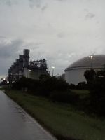
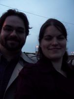
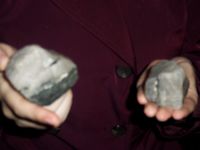
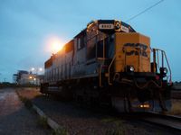
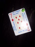
We parked at the terminal, grabbed our coats for the rain... and the rain abruptly stopped. Nature really did not want to let us claim a drowned rat. We walked down the edge of the tracks while Erica was continuously on edge. Turned out the high-pitched hum of the nearby industrial plant that I had tuned out was one of the few things she couldn't tune out. Thankfully, it wasn't a long walk until we reached our point. Erica found some big chunks of quartz that she had to take with her. We made it back to the car and put the Seven of Diamonds on a nearby power line support, just like the previous marker. First successful multihash!
Gallery
- Photo Gallery
Achievables
Geoff earned the Consecutive geohash achievement
|
Geoff earned the Multihash Achievement
|
