Difference between revisions of "2010-08-04 47 -122"
From Geohashing
imported>Thomcat ((slash) there goes another Ninja!) |
imported>FippeBot m (Location) |
||
| (One intermediate revision by one other user not shown) | |||
| Line 24: | Line 24: | ||
--> | --> | ||
<gallery perrow="5"> | <gallery perrow="5"> | ||
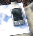
| + | Image:2010-08-04_47_-122_Chalking.jpg | Chalking | ||
| + | Image:2010-08-04_47_-122_Proof.jpg | Inset of previous - proof | ||
| + | Image:2010-08-04_47_-122_Chalkers.jpg | Chalkers | ||
| + | Image:2010-08-04_47_-122_ChalkPride.jpg | Chalk Pride! | ||
| + | Image:2010-08-04_47_-122_ToTheBeach.jpg | On to the beach | ||
| + | Image:2010-08-04_47_-122_Boat.jpg | Seattle Public Transport | ||
| + | Image:2010-08-04_47_-122_FerryLeaving.jpg | Ferry leaving | ||
</gallery> | </gallery> | ||
| Line 29: | Line 36: | ||
[[Category:Expeditions with photos]] | [[Category:Expeditions with photos]] | ||
[[Category:Coordinates reached]] | [[Category:Coordinates reached]] | ||
| + | {{location|US|WA|KN}} | ||
Latest revision as of 03:06, 9 August 2019
| Wed 4 Aug 2010 in 47,-122: 47.5373829, -122.3686877 geohashing.info google osm bing/os kml crox |
Location
On a Traffic Circle in West Seattle
Participants
Thomcat and drag-along son
Expedition
Wednesday, nice weather, unemployed, daughter out of town at camp. What else to do - Geohash!
To get to here you have to head downhill from the main road into a fairly residential neighborhood. We found the exact spot quite easily, then spent some quality time with the various colors of chalk. I don't think anyone could miss that.
Then we headed back up to the top of the hill and down the other side to Lincoln Park, our designated alternate meetup location. From here we walked along the waterfront, skipping stones and exploring. A great day!


