Difference between revisions of "2011-08-29 49 -124"
imported>FippeBot m (Location) |
m |
||
| (One intermediate revision by one other user not shown) | |||
| Line 28: | Line 28: | ||
[[Category:Expeditions]] | [[Category:Expeditions]] | ||
[[Category:Coordinates not reached]] | [[Category:Coordinates not reached]] | ||
| − | {{location|CA|BC}} | + | [[Category:Not reached - No public access]] |
| + | {{location|CA|BC|AC}} | ||
Latest revision as of 11:46, 22 April 2022
| Mon 29 Aug 2011 in 49,-124: 49.3297455, -124.9905078 geohashing.info google osm bing/os kml crox |
Location
West of Port Alberni.
Participants
Expedition
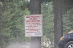
Unfortunately, I can't remember too much, as I'm writing this almost a year later. We were on the way to Tofino, and hoped to make this a short detour on the way there. Unfortunately, it didn't work out. We got to within about 1km (around where Great Central Road and Central Lake Road meet, south of the geohash) before being stopped. There was construction going on, and we decided not to ignore the sign warning us about the radio procedures in place beyond that point.
Disappointed, I was silly and forgot to take a picture of the GPS. Thus, I don't actually have solid proof that we were only ~1km away.
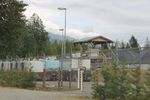
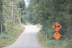
The first photo was the closest point we reached, and the following three were on the way back to the main road.


