Difference between revisions of "2008-05-24 34 -118"
imported>Darcy m |
imported>FippeBot m (Location) |
||
| (9 intermediate revisions by 8 users not shown) | |||
| Line 4: | Line 4: | ||
| lon=-118 | | lon=-118 | ||
| date=2008-05-24 | | date=2008-05-24 | ||
| + | | graticule_name=Los Angeles | ||
| + | | graticule_link=Los Angeles, California | ||
}} | }} | ||
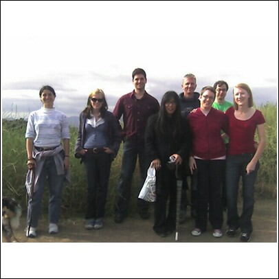
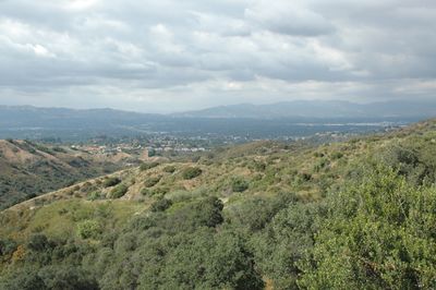
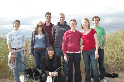
| − | The meetup point was in [http://www.parks.ca.gov/?page_id=629 Topanga State Park] near the western fork of Caballero Creek and north of Mulholland Drive. The point itself was inaccessible, but nine people and a dog (representing | + | The meetup point was in [http://www.parks.ca.gov/?page_id=629 Topanga State Park] near the western fork of Caballero Creek and north of Mulholland Drive. The point itself was inaccessible, but nine people and a dog (representing five independent groups) gathered on Mulholland Drive after hiking from the end of Reseda Blvd. We were about 250 feet from the geohashed location. Photographs were taken and six degrees of separation was unintentionally played. |
In attendance were: | In attendance were: | ||
| − | [[User:Darcy|Darcy]], Sally, Tatters (the dog), Ryka, Zarah, Lauren, Art, Ilya, Mike and | + | [[User:Darcy|Darcy]], Sally, Tatters (the dog), Ryka, Zarah, Lauren, [[User:ArtInLA|Art]], [[User:IlyaHaykinson|Ilya]], [[User:SouthLAMike|Mike]] and Erin. |
| − | + | Many were tardy due to Google Maps' inaccurate advice to drive down a gated, dirt fire road. Bad Google! | |
[[Image:FirstLAmeetup.jpg]] | [[Image:FirstLAmeetup.jpg]] | ||
| + | [[Image:Los Angeles geohash 20080524 - location.jpg|400px|thumb|The location]] | ||
| + | [[Image:Los Angeles geohash 20080524 - people.jpg|400px|thumb|The attendees]] | ||
| Line 23: | Line 27: | ||
Do not try to take Mulholland from the 405...there is a gate. If you're in the mood for a short hike, an alternative route is to take Reseda Ave south until it dead ends at the gate...continue on foot until you get to Mulholland, turn left and go another 0.7 miles. | Do not try to take Mulholland from the 405...there is a gate. If you're in the mood for a short hike, an alternative route is to take Reseda Ave south until it dead ends at the gate...continue on foot until you get to Mulholland, turn left and go another 0.7 miles. | ||
| + | |||
| + | [[Category:Expeditions]] | ||
| + | [[Category:Expeditions with photos]] | ||
| + | [[Category:Coordinates reached]] | ||
| + | {{location|US|CA|LO}} | ||
Latest revision as of 04:04, 7 August 2019
| Sat 24 May 2008 in Los Angeles: 34.1266480, -118.5475331 geohashing.info google osm bing/os kml crox |
The meetup point was in Topanga State Park near the western fork of Caballero Creek and north of Mulholland Drive. The point itself was inaccessible, but nine people and a dog (representing five independent groups) gathered on Mulholland Drive after hiking from the end of Reseda Blvd. We were about 250 feet from the geohashed location. Photographs were taken and six degrees of separation was unintentionally played.
In attendance were: Darcy, Sally, Tatters (the dog), Ryka, Zarah, Lauren, Art, Ilya, Mike and Erin.
Many were tardy due to Google Maps' inaccurate advice to drive down a gated, dirt fire road. Bad Google!
Old Planning Information
5/24/08: The location for the first Saturday meetup is perfect in every way: it's on public land (Topanga State Park!), out in the mountains, but accessible by a road (just off Mulholland Drive), and a relatively short drive for most residents of the city and the valley (unless you live in Lancaster...). Considering that much of our graticule is either inaccessible mountains or distant desert (unless you live in Lancaster), this is a fortunate hash indeed. Let's represent, LA! 4:00pm.
update: Scoping out the coordinates in gEarth... The easiest way to get there is to take the 101 to Canoga Ave. south, left on Golondrina, right on Alhama, left on Mulholland, go 3.9 miles. If you don't have a gps, remember to set your odometer. This part of Mulholland is a graded dirt road, but it appears suitable for passenger vehicles. It looks like there is a trailhead on the north side of the road and a trail heading north, under the powerlines and down the ridge. The coordinates are ~260 ft. down this trail.
Do not try to take Mulholland from the 405...there is a gate. If you're in the mood for a short hike, an alternative route is to take Reseda Ave south until it dead ends at the gate...continue on foot until you get to Mulholland, turn left and go another 0.7 miles.


