Difference between revisions of "2012-09-07 -35 149"
imported>1PE (Created page with "{{subst:Expedition |lat = -35 |lon = 149 |date = 2012-09-07}}") |
m (More specific location) |
||
| (3 intermediate revisions by 3 users not shown) | |||
| Line 1: | Line 1: | ||
| + | [[Image:{{{image|2012-09-07 -35 149 508.JPG}}}|thumb|left]] | ||
| + | [[Image:{{{image|2012-09-07 -35 149 letterbox2.JPG}}}|thumb|left]] | ||
| − | |||
| − | |||
| − | |||
| − | |||
| − | |||
| − | |||
| − | |||
| − | |||
| − | |||
{{meetup graticule | {{meetup graticule | ||
| lat=-35 | | lat=-35 | ||
| Line 15: | Line 8: | ||
}} | }} | ||
| − | |||
__NOTOC__ | __NOTOC__ | ||
== Location == | == Location == | ||
| − | + | In a field of an extensive grazing property north-east of Kowen. | |
== Participants == | == Participants == | ||
| − | + | [[User:1PE|1PE]] | |
| − | |||
== Plans == | == Plans == | ||
| − | + | ===1PE=== | |
| + | Lunchtime excursion, about 20 minutes from work. | ||
== Expedition == | == Expedition == | ||
| − | + | ===1PE=== | |
| + | I'd only been across this road about 15 hours before and had forgotten the roadworks already. :-( | ||
| + | |||
| + | Sutton Road, the Norton Road, then looking for the turn-off. Found; and a closed gate that was to be expected! Pictures of the gate and letterbox. | ||
| − | + | Back around onto the more developed road to the south where "acrage blocks" back onto the much larger grazing farm. I find the gate and letter box of the property that backs onto where the hash is sited. Another note in the letterbox, and another pic. | |
| − | |||
== Photos == | == Photos == | ||
| − | |||
| − | |||
| − | |||
<gallery perrow="5"> | <gallery perrow="5"> | ||
| + | file:2012-09-07 -35 149 508.JPG|Far (several kilometers) across the fields of #508 | ||
| + | file:2012-09-07 -35 149 Old Kowen.JPG|The gate, and the name of the farm | ||
| + | file:2012-09-06 -35 149 fields.JPG|Looking past the gate drive towards the hash | ||
| + | file:2012-09-07 -35 149 note2.JPG|Second note at the southern boundary property | ||
| + | file:2012-09-07 -35 149 letterbox2.JPG|A second letterbox | ||
</gallery> | </gallery> | ||
| Line 44: | Line 40: | ||
<!-- Add any achievement ribbons you earned below, or remove this section --> | <!-- Add any achievement ribbons you earned below, or remove this section --> | ||
| − | |||
| − | |||
| − | |||
| − | |||
| − | |||
| − | |||
| − | |||
| − | |||
| − | |||
| − | |||
| − | |||
[[Category:Expeditions]] | [[Category:Expeditions]] | ||
| − | |||
[[Category:Expeditions with photos]] | [[Category:Expeditions with photos]] | ||
| − | |||
| − | |||
| − | |||
| − | |||
| − | |||
| − | |||
| − | |||
| − | |||
| − | |||
[[Category:Coordinates not reached]] | [[Category:Coordinates not reached]] | ||
| − | |||
| − | |||
| − | |||
| − | |||
| − | |||
[[Category:Not reached - No public access]] | [[Category:Not reached - No public access]] | ||
| − | + | {{location|AU|NSW|QB}} | |
| − | |||
| − | |||
| − | |||
| − | |||
| − | |||
| − | |||
| − | |||
Latest revision as of 12:22, 1 August 2020


| Fri 7 Sep 2012 in -35,149: -35.2626457, 149.3186415 geohashing.info google osm bing/os kml crox |
Location
In a field of an extensive grazing property north-east of Kowen.
Participants
Plans
1PE
Lunchtime excursion, about 20 minutes from work.
Expedition
1PE
I'd only been across this road about 15 hours before and had forgotten the roadworks already. :-(
Sutton Road, the Norton Road, then looking for the turn-off. Found; and a closed gate that was to be expected! Pictures of the gate and letterbox.
Back around onto the more developed road to the south where "acrage blocks" back onto the much larger grazing farm. I find the gate and letter box of the property that backs onto where the hash is sited. Another note in the letterbox, and another pic.
Photos
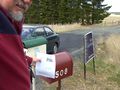
Far (several kilometers) across the fields of #508
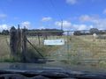
The gate, and the name of the farm
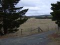
Looking past the gate drive towards the hash
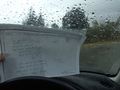
Second note at the southern boundary property
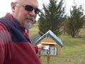
A second letterbox


