Difference between revisions of "2008-05-24 48 -122"
imported>Thomcat (Success/failure category added) |
imported>FippeBot m (Location) |
||
| (One intermediate revision by one other user not shown) | |||
| Line 25: | Line 25: | ||
[[Category:Expeditions with photos]] | [[Category:Expeditions with photos]] | ||
[[Category:Coordinates not reached]] | [[Category:Coordinates not reached]] | ||
| − | [[Category: | + | [[Category:Not reached - Mother Nature]] |
| + | {{location|US|WA|IS}} | ||
Latest revision as of 04:11, 7 August 2019
| Sat 24 May 2008 in 48,-122: 48.1266480, -122.5475331 geohashing.info google osm bing/os kml crox |
Contents
About
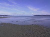
The actual coordinates were about .75mi offshore, but were close enough to an out of the way beach with public access that it was worth checking out. Only I (Evan) showed, no sign of Matt, but it was a good way to spend the Saturday afternoon. The beach is known for clamming and mussel picking. There were countless mussels, but no clams were located, despite eager digging efforts. Saw some gulls digging for something out on a sandbar, so I made my way out there through the shoreline-quicksand (you gotta move FAST if you don't want to sink!) only to find the gulls were eating some sand worm (a bit smaller than Dune). On the return, the rising tide was closing off the sandbar, and had I hesitated 30sec more, I would have likely been washed to sea!
This was followed by a beautiful hike at the nearby Ebey Bluffs.
People
Notes of interest
- The mini-crab I encountered clearly was trying to challenge me to a dual (just like this if I were the hornet). No time to spar, however, as Mr. Crab had the tide to his advantage.
