Difference between revisions of "2013-04-12 39 -77"
imported>OfficeLinebacker (An expedition message sent via Geohash Droid for Android.) |
imported>FippeBot m (Location) |
||
| (12 intermediate revisions by 3 users not shown) | |||
| Line 1: | Line 1: | ||
| − | |||
| − | |||
| − | |||
| − | |||
| − | |||
| − | |||
| − | |||
| − | |||
| − | |||
| − | |||
{{meetup graticule | {{meetup graticule | ||
| lat=39 | | lat=39 | ||
| Line 19: | Line 9: | ||
== Location == | == Location == | ||
<!-- where you've surveyed the hash to be --> | <!-- where you've surveyed the hash to be --> | ||
| + | In a field in Ashton, MD | ||
== Participants == | == Participants == | ||
<!-- who attended: If you link to your wiki user name in this section, your expedition will be picked up by the various statistics generated for geohashing. You may use three tildes ~ as a shortcut to automatically insert the user signature of the account you are editing with. | <!-- who attended: If you link to your wiki user name in this section, your expedition will be picked up by the various statistics generated for geohashing. You may use three tildes ~ as a shortcut to automatically insert the user signature of the account you are editing with. | ||
--> | --> | ||
| + | [[User:OfficeLinebacker|OfficeLinebacker]] ([[User talk:OfficeLinebacker|talk]])OfficeLinebacker | ||
== Plans == | == Plans == | ||
| Line 29: | Line 21: | ||
== Expedition == | == Expedition == | ||
<!-- how it all turned out. your narrative goes here. --> | <!-- how it all turned out. your narrative goes here. --> | ||
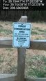
| + | It turns out this is really close to my buddy Phil's house. I parked in a cul-de-sac in a housing development that was not built yet, and traversed the area designated as "LOT 12." Hopped a couple of construction fences and saw another fence with the sign pictured. | ||
| + | |||
| + | Had to traverse an area of intense pricking vines, then came to another fence. Hopped it and walked out into the field. | ||
| + | |||
| + | My GPS navigation skills are getting better, as I had to do hardly any "GPS dancing." Just a few course corrections as I walked and I was there. | ||
== Tracklog == | == Tracklog == | ||
| Line 38: | Line 35: | ||
--> | --> | ||
<gallery perrow="5"> | <gallery perrow="5"> | ||
| + | |||
| + | Image:2013-04-12_39_-77_14-12-29-999.jpg | I love natural bridges [http://www.openstreetmap.org/?lat=39.15406492&lon=-77.02423615&zoom=16&layers=B000FTF @39.1541,-77.0242] | ||
| + | |||
| + | Image:2013-04-12_39_-77_14-16-27-321.jpg | Silly grin [http://www.openstreetmap.org/?lat=39.15448025&lon=-77.02240910&zoom=16&layers=B000FTF @39.1545,-77.0224] | ||
| + | |||
| + | Image:2013-04-12_39_-77_14-16-44-091.jpg | Beautiful [http://www.openstreetmap.org/?lat=39.15448025&lon=-77.02240927&zoom=16&layers=B000FTF @39.1545,-77.0224] | ||
| + | |||
| + | Image:2013-04-12_39_-77_14-17-07-434.jpg | Another view [http://www.openstreetmap.org/?lat=39.15448025&lon=-77.02240933&zoom=16&layers=B000FTF @39.1545,-77.0224] | ||
| + | |||
| + | Image:2013-04-12_39_-77_14-19-42-682.jpg | Doesn't say no trespassing. [http://www.openstreetmap.org/?lat=39.15437725&lon=-77.02377810&zoom=16&layers=B000FTF @39.1544,-77.0238] | ||
| + | |||
| + | Image:2013-04-12_39_-77_14-26-45-120.jpg | These nasty things have quickly become my greatest obstacles [http://www.openstreetmap.org/?lat=39.15389517&lon=-77.02536428&zoom=16&layers=B000FTF @39.1539,-77.0254] | ||
| + | |||
| + | Image:2013-04-12_39_-77_14-28-19-540.jpg | Last bit of clearing on my way back to my car [http://www.openstreetmap.org/?lat=39.15370952&lon=-77.02605133&zoom=16&layers=B000FTF @39.1537,-77.0261] | ||
</gallery> | </gallery> | ||
| Line 44: | Line 55: | ||
<!-- Add any achievement ribbons you earned below, or remove this section --> | <!-- Add any achievement ribbons you earned below, or remove this section --> | ||
| − | |||
| − | |||
| − | |||
| − | |||
| − | |||
| − | |||
| − | |||
| − | |||
| − | |||
| − | |||
| − | |||
[[Category:Expeditions]] | [[Category:Expeditions]] | ||
| − | |||
[[Category:Expeditions with photos]] | [[Category:Expeditions with photos]] | ||
| − | |||
| − | |||
| − | |||
| − | |||
| − | |||
[[Category:Coordinates reached]] | [[Category:Coordinates reached]] | ||
| − | + | {{location|US|MD|MO}} | |
| − | |||
| − | |||
| − | |||
| − | |||
| − | |||
| − | |||
| − | |||
| − | |||
| − | |||
| − | |||
| − | |||
| − | |||
| − | |||
| − | |||
| − | |||
| − | |||
| − | |||
Latest revision as of 01:50, 14 August 2019
| Fri 12 Apr 2013 in 39,-77: 39.1544702, -77.0223777 geohashing.info google osm bing/os kml crox |
Location
In a field in Ashton, MD
Participants
OfficeLinebacker (talk)OfficeLinebacker
Plans
Expedition
It turns out this is really close to my buddy Phil's house. I parked in a cul-de-sac in a housing development that was not built yet, and traversed the area designated as "LOT 12." Hopped a couple of construction fences and saw another fence with the sign pictured.
Had to traverse an area of intense pricking vines, then came to another fence. Hopped it and walked out into the field.
My GPS navigation skills are getting better, as I had to do hardly any "GPS dancing." Just a few course corrections as I walked and I was there.
Tracklog
Photos
I love natural bridges @39.1541,-77.0242
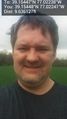
Silly grin @39.1545,-77.0224
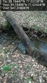
Beautiful @39.1545,-77.0224
Another view @39.1545,-77.0224
Doesn't say no trespassing. @39.1544,-77.0238
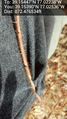
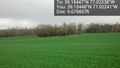
These nasty things have quickly become my greatest obstacles @39.1539,-77.0254
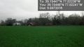
Last bit of clearing on my way back to my car @39.1537,-77.0261


