Difference between revisions of "2013-05-21 63 29"
imported>Pastori (Pastori celebrates the Geohashing Day.) |
imported>FippeBot m (Location) |
||
| (One intermediate revision by one other user not shown) | |||
| Line 53: | Line 53: | ||
}} | }} | ||
| − | |||
| − | |||
| − | |||
[[Category:Expeditions]] | [[Category:Expeditions]] | ||
[[Category:Expeditions with photos]] | [[Category:Expeditions with photos]] | ||
[[Category:Coordinates reached]] | [[Category:Coordinates reached]] | ||
| + | {{location|FI|13}} | ||
Latest revision as of 02:27, 14 August 2019
| Tue 21 May 2013 in 63,29: 63.7030771, 29.2446807 geohashing.info google osm bing/os kml crox |
Location
In the village of Saramo, Nurmes. The point lies in a forest near the hiking trail Saramon jotos.
Participants
- Pastori
- The Wife
Plans
Today in the International Geohashing Day Pastori and The Wife had definitely planned to visit a geohashpoint in some of nearby graticules. Since the point in their home graticule seemed to be on a swamp, they decided to pay a visit to the neighbouring Nurmes graticule.
Expedition
The beautiful morning was full of summer when we left about 9:10 by car towards the hashpoint in the village of Saramo. The distance was about 60 km. The way there we drove mainly on tarmac roads and in the end a few kilometers on small forest roads. In Finland there are roads built in the forests so densely, that most of the time there is no more than 500 meters between the roads. We geohashers can take advantage of all that effort nicely. The roads have of course been built for us, and have nothing to do with matters related to forest management, that is for sure.
We found the spot easily and there was only 69 meters of walk from the car to the point. Our accuracy was again splendid, less than half a meter. The point was, surprisingly (or not..), in the middle of a forest! In the spot Pastori tried to gaze at the sky to send a thanks to those good satellites.
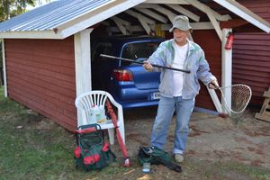
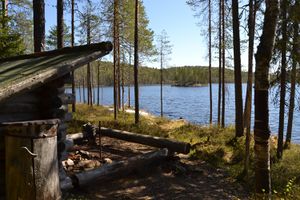
On the way back we drove the same 60 km, but now all the time on small gravel roads, and then some even smaller gravel pathways. In between we stopped to have a picnic on a lean-to by a lake. Pastori also opened his fishing season by casting with a reel for some time, but with no luck.
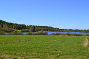
Our Geohashing Day trip was a successful nature trip to real wilderness, where the loudest noise was the calling of cuckoos and singing of birds. It was restful and wonderful to enjoy the warmth and the gentle green colors of the beginning summer.
Additional photos
Achievements
Pastori and The Wife earned the 2013 Geohashing Day achievement
|
Pastori earned the Land geohash achievement
|


