Difference between revisions of "2013-05-26 64 26"
From Geohashing
imported>GeorgDerReisende |
m (per Renaming Proposal) |
||
| (One intermediate revision by one other user not shown) | |||
| Line 33: | Line 33: | ||
{{#vardefine:ribbonwidth|800px}} | {{#vardefine:ribbonwidth|800px}} | ||
| − | {{ | + | {{Graticule unlocked |
| latitude = 64 | | latitude = 64 | ||
| longitude = 26 | | longitude = 26 | ||
| Line 47: | Line 47: | ||
[[Category:Expeditions with photos]] | [[Category:Expeditions with photos]] | ||
[[Category:Coordinates reached]] | [[Category:Coordinates reached]] | ||
| + | {{location|FI|05}} | ||
Latest revision as of 05:24, 20 March 2024
| Sun 26 May 2013 in 64,26: 64.1145906, 26.9600620 geohashing.info google osm bing/os kml crox |
Location
In Kajaani, in a forest.
Participants
- Pastori
- The Wife
Expedition
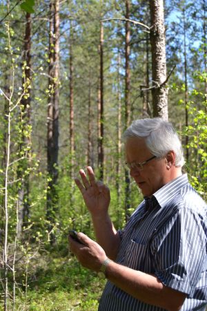
Last day of the road trip of Pastori and The Wife, second-to-last hashpoint. The first hashvisit of the trip.
This one was right beside the road, only about 70 meters on an easily traversable mixed forest. Pastori's leg also cooperated better now. The point was within the borders of city of Kajaani, about 50 km from the city center. That is all from this point.
Our trip continued homewards.
Additional photos
Achievements
Pastori earned the Graticule Unlocked Achievement
|
Pastori earned the Land geohash achievement
|


