Difference between revisions of "2013-07-04 54 -1"
imported>JMuonio |
imported>FippeBot m (Location) |
||
| (One intermediate revision by one other user not shown) | |||
| Line 45: | Line 45: | ||
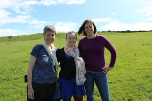
Image:2013-07-04_54_-1_Map_reading_s.jpg| Susanne and Jess checking the map. | Image:2013-07-04_54_-1_Map_reading_s.jpg| Susanne and Jess checking the map. | ||
Image:2013-07-04 54 -1 Kwikfit-small.jpg| Why George couldn't come along. | Image:2013-07-04 54 -1 Kwikfit-small.jpg| Why George couldn't come along. | ||
| − | |||
</gallery> | </gallery> | ||
| Line 75: | Line 74: | ||
[[Category:Expeditions with photos]] | [[Category:Expeditions with photos]] | ||
[[Category:Coordinates reached]] | [[Category:Coordinates reached]] | ||
| + | {{location|GB|ENG|NBL}} | ||
Latest revision as of 06:10, 6 August 2019
| Thu 4 Jul 2013 in 54,-1: 54.9367959, -1.8922555 geohashing.info google osm bing/os kml crox |
Location
A sheep pasture off of Mickley Grange south of Stocksfield, Northumberland, United Kingdom.
Participants
- Mcbaneg (talk) (George, nonparticipant but puppetmaster)
- Anita (along for ride but not the walk to the hashpoint)
Expedition
Today's intrepid group of five had rented a car for a day trip to visit Hadrian's Wall and several nearby Roman sites. George, with an eye on a Puppetmaster achievement, knowing that non-geohashers Eve and Anita were along for the trip, and knowing that Jess wouldn't be able to resist the suggestion, pointed out within her earshot that the day's hashpoint was only a few miles off of the planned route. As a bonus the weather was absolutely perfect. George couldn't join the trip himself on account of (1) having to take our regular hashcar for a new battery (garage receipt posted below) and (2) having to work.
Navigating to the site turned out to be a rather simple task, and a small path off the main road, Mickley Grange, provided a convenient parking place. The hashpoint was on the slope of a hill, providing a view into a beautiful section of the valley of the River Tyne. We crossed a fence and walked a few hundred feet into the pasture to the hash point, which was on the far side of a distinctive “V” of trees. The herd of sheep, which we noticed earlier in the satellite map of the site, were, in fact, the field, much to the delight of Jess.
A fifth member of the party, Anita, declined to climb through the fence and stayed back with the car.
So, four Americans, with an American puppetmaster, complete an English geohash on the 4th of July!
Photos
Achievements
Susanne, Jake, Jessica, and Eve earned the Land geohash achievement
|
Mcbaneg (George) earned the Puppet Master Geohash achievement
|


