Difference between revisions of "2013-07-26 62 24"
imported>Tilley (Tilley conquers a new graticule!) |
m (per Renaming Proposal) |
||
| (2 intermediate revisions by 2 users not shown) | |||
| Line 21: | Line 21: | ||
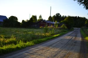
[[File:2013-07-26_62_24_DSC3493_1500px.jpg|200px|thumb|right|The actual Jukojärvi special stage.]] | [[File:2013-07-26_62_24_DSC3493_1500px.jpg|200px|thumb|right|The actual Jukojärvi special stage.]] | ||
| − | About 20 o'clock I started my ride. The weather was perfect. Clear sky, the Sun was beginning to settle down but still gave some warmth. Temperature was about | + | About 20 o'clock I started my ride. The weather was perfect. Clear sky, the Sun was beginning to settle down but still gave some warmth. Temperature was about 23°C. First 10 kilometers were along a quiet gravel country road. Five kilometers of my route took place along the special stage Jukojärvi of the not-so-quiet [http://www.nesteoilrallyfinland.fi/en/ Neste Oil Rally Finland]. A rally road of course has plenty of bends and steep hills - so did this one. The road was in decent condition - now. In a week, when the rally is over, it will be horrifying. After the gravel stretch I turned into the Multia-Petäjävesi tarmac road for another 10 km. This was familiar route for me. |
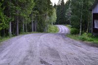
[[File:2013-07-26_61_24_DSC3470_1500px.jpg|200px|thumb|left|On the road.]] | [[File:2013-07-26_61_24_DSC3470_1500px.jpg|200px|thumb|left|On the road.]] | ||
| Line 52: | Line 52: | ||
{{#vardefine:ribbonwidth|800px}} | {{#vardefine:ribbonwidth|800px}} | ||
| − | {{ | + | {{Graticule unlocked |
| latitude = 62 | | latitude = 62 | ||
| longitude = 24 | | longitude = 24 | ||
| Line 71: | Line 71: | ||
[[Category:Expeditions with photos]] | [[Category:Expeditions with photos]] | ||
[[Category:Coordinates reached]] | [[Category:Coordinates reached]] | ||
| + | {{location|FI|08}} | ||
Latest revision as of 05:23, 20 March 2024
| Fri 26 Jul 2013 in 62,24: 62.4892519, 24.8853541 geohashing.info google osm bing/os kml crox |
Location
In Linnanmäki, Multia. The point lies in a forest.
Participants
Plans
I had spent a couple of weeks with my family in my parents'-in-law place in Keuruu graticule. I had of course watched closely for geohashes the entire time - especially because the graticule was still a virgin one. My luck had been poor, no hashes fell within reasonable distance. Then, as the stay was approaching end, I decided I had to give it a go, no matter what. Luckily a good one appeared just then. According to Google maps the route to the hashpoint was 27 km. I would have to do the expedition in the evening after the Sleeping Beauty -baby had gone to sleep - the distance was too much for her. The temperature would also be nicer then.
Expedition
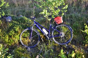
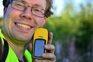
The fastest bike available was my wife's hybrid bike, which had just long enough saddle tube to suit me, when I raised it to the maximum height. The riding position was not bad, but not the greatest either. I packed along GPS, camera, phone, some bicycle tools, two liters of water and a banana.
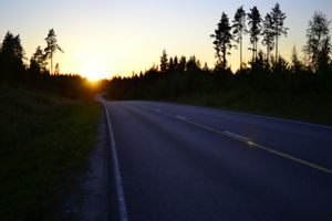
About 20 o'clock I started my ride. The weather was perfect. Clear sky, the Sun was beginning to settle down but still gave some warmth. Temperature was about 23°C. First 10 kilometers were along a quiet gravel country road. Five kilometers of my route took place along the special stage Jukojärvi of the not-so-quiet Neste Oil Rally Finland. A rally road of course has plenty of bends and steep hills - so did this one. The road was in decent condition - now. In a week, when the rally is over, it will be horrifying. After the gravel stretch I turned into the Multia-Petäjävesi tarmac road for another 10 km. This was familiar route for me.
After some big hills was the turn to another gravel road. I had marked this turn to my GPS, but was still a bit unsure if it was the right intersection. I didn't remember what was supposed to be the name of the road (also: names on Google Maps are not always correct) and none of the road signs told of any places I remembered on the way to the hashpoint. Luckily there was a small noteboard at the intersection which contained among the advertisements of local summer theater and such also a map of a nearby hiking trail. From that I could deduce I was at the right intersection. There was about 6 km to the next intersection.
So I continued in beautiful country scenery. The gracefully setting Sun reddening the roadsides, well-kept gardens of idyllic houses lining the road, cows returning to cowshed to be milked, an ant flying into my mouth and biting my tongue. Wait, what? Some swarms of insects had gathered over the road to take advantage of the warmth of the day that had deposited on the roadbed. Suddenly I felt one hitting my mouth as I was breathing mouth open. As I tried to spit it out, it wiggled and bit my tongue. I finally managed to get the beast out with my fingers, and saw it was indeed an ant with wings. Very peculiar.
The next intersection was easily located with the help of GPS. Now only 1 km to the hashpoint. Even this last, smaller road was in good condition, and the hashpoint was quickly located. There was only 45 meters from the road to the point, which was in a clear-cut forest. I parked my bike, ate the banana and drank some water. Then I walked to the hash and took some pictures for proof. The Sun was still beautifully low. I reached the hashpoint at 21:13, but there was still another hour until the sunset. The summer days of Northland are long still in the end of July. Then back to bike, equipment on and onto return journey.
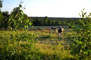
On the way back I stopped again to take a photograph of the cows, because my first picture going the other way had failed. Their guard-cow apparently didn't like that and came runningly to challenge me. Luckily there was a fence between us, so I could take his picture anyway. Neener-neener.
The hills did not only feel steep when going up them - now as was riding down I reached a top speed of 58 km/h. Rest of the journey went along the now-familiar roads and making a few stops to take some pictures. Once a young rabbit tried to run under me, but turned away when reaching the ditch on roadside. What's with animals trying to hit me while riding this evening?
When reaching my place of stay I was a bit saddle-sore but reaching this long-awaited hashpoint felt great! My whole trip was 54,9 km, average speed (including the walk to the hashpoint and back) was 22,4 km/h and maximum the above-mentioned 58 km/h.
Additional photos
Achievements
Tilley earned the Graticule Unlocked Achievement
|
Tilley earned the Bicycle geohash achievement
|
Tilley earned the Land geohash achievement
|
