Difference between revisions of "2013-08-02 63 28"
imported>Tilley (Created page with "{{meetup graticule | lat=63 | lon=28 | date=2013-08-02 }} __NOTOC__ == Location == On the slopes of forested hill Kiuruvaara, in Halmejärvi, Valtimo. == Participants == *[...") |
imported>FippeBot m (Location) |
||
| (One intermediate revision by one other user not shown) | |||
| Line 51: | Line 51: | ||
Land geohash. | Land geohash. | ||
| − | |||
| − | |||
[[Category:Expeditions]] | [[Category:Expeditions]] | ||
[[Category:Expeditions with photos]] | [[Category:Expeditions with photos]] | ||
[[Category:Coordinates reached]] | [[Category:Coordinates reached]] | ||
| + | {{location|FI|13}} | ||
Latest revision as of 03:26, 14 August 2019
| Fri 2 Aug 2013 in 63,28: 63.7553272, 28.7737179 geohashing.info google osm bing/os kml crox |
Location
On the slopes of forested hill Kiuruvaara, in Halmejärvi, Valtimo.
Participants
Plans
As I was visiting Pastori and The Wife, the hashpoint fell conveniently close, only 7 km straight. Pastori had other appointments, so I will do a solo expedition and combine it with a mountain bike ride.
Expedition
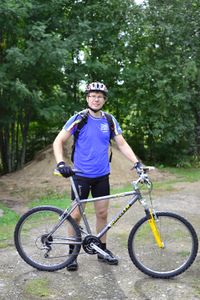
Preparing for the trip, I had carefully marked all the intersections on the trail I intended to take to GPS. There were some forest path sections, but majority of the route would be on gravel roads of varying widths. Some bicycle tools and couple of liters of water to backpack, last adjustments to my newly put together secondary mountain bike, and on the way!
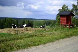
First few kilometers were familiar roads in always beautiful Northern Karelian countryside. The weather was also perfect: the fog that had covered the ground in the night had vanished and the sun was shining. It was not too hot though, as there were some clouds. The roads were quite bumpy. My GPS shut itself down a couple of time because of too big hits. It didn't help that my mountain bike is actually a rigid one, some previous owner had made the cheap suspension fork a non-suspension one by bolting the slide tubes together.
After the first path section the road got smaller and started to climb up to the forested hill. This time my pre-keyed-in route on GPS worked perfecly and I found all the right intersections. At one point my route passed an abandoned house, which maybe was serving as an occasional summer cottage, because the hay from the yard had been cut at least once this summer. After the last turn before the hashpoint, the gravel road got still smaller and was barely passable by car. The actual road ended and there was a forest machine trail leading still further towards the hashpoint. The trail was in surprisingly good condition and easily rideable. I could get by bike about 90 meters from the hashpoint.
First 20 meters or so were very slow going as there were a lot of young trees felled in a criss-cross fashion. After that the forest was quite a normal bilberry-type pine forest. There also were a lot of bilberries, some of which I stopped to pick to my mouth. The massive hordes of mosquitoes buzzing around my calves prevented further hoarding, though. I proceeded to the hashpoint in a mysteriously curvy path, but got the GPS to stop to 0,5 meters accuracy. Some pictures, a little more bilberries and then a quick escape from the mosquitoes.
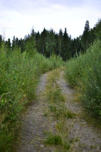
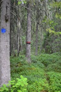
Hashpoint successfully visited, I continued my ride with high spirits. The spirits were tough to keep in my next part of the route, though, which was a part of the UKK trail. This was because it was completely unmaintained at this section. The part that was in the older forest was partly rideable, and there were only about a dozen trees that had fallen on the route. Then the route opened into an overgrown meadow, and there I lost it completely and ended up carrying the bike around looking for the route for few minutes. Someone had even deliberately tried to sabotage the route by felling young trees across the trail. (More of the UKK trail in this expedition report.)
After the UKK disaster I still rode around some small gravel roads and returned to my place of stay.
Trip statistics: length 33 km, average speed 15,2 km/h (including all the walks and bike carryings and such), maximum 47,4 km/h.
Additional photos
Achievements
Tilley earned the Bicycle geohash achievement
|
Land geohash.


