Difference between revisions of "2013-10-12 50 11"
imported>Jens (Created page with "{{meetup graticule | lat=50 | lon=11 | date=2013-10-12 }} __NOTOC__ == Location == On a small hill near Gumperda. == Participants == * Jens and Räbe == Expe...") |
imported>FippeBot m (Location) |
||
| (4 intermediate revisions by 2 users not shown) | |||
| Line 13: | Line 13: | ||
== Expedition == | == Expedition == | ||
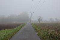
| − | + | Juja is not here this weekend but she left the order for me to take care about today’s point. And obedient I am, I went there. Well the weather was, let’s say, perfect. Not too hot, but warm enough that the water in the bottle didn’t freeze. And it did not rain. All the water available was bound in fog, nothing was left to form rain drops. | |
| + | |||
| + | I started early in the morning in south direction, passed the cookie factory without (yes indeed) entering it and followed the Saale bike path to Kahla. There I left the familiar way and followed the small road to Gumperda. I can’t tell anything about the landscape, since it was hidden behind a wall of fog. In Gumperda, fidirallalla, I parked my bike at a fence and went the last meters on foot. | ||
| + | |||
| + | The first 400 of the last 500 meters were very atypical. There was a way. On the left side a fence, on the right side a fence, as if they would say: “Just follow us, we will lead you to the point.” And they did. At least the one on the right side. For the last 100 meters the way was substituted by very wet grass, but the fence stayed by my side until the end. | ||
| + | |||
| + | Meanwhile I found out that the task of the fence was not only to lead me to the point but also to arrest some horses. Probably these horses are the only persons that really reached the point today, since the closest distance I was able to reach outside were 2 meters. But that’s in the GPS signal tolerance, so it must be good enough. | ||
| + | |||
| + | For my way back I climbed up a small road from Reinstädt to Milda, that was on the second part not much better than the mud path between the fences. So finally the 15 km bee line became a 50 km tour in reality, as always. And thanks to the wet grass, I had well cooled feet on the way home. I didn’t measure it, but it still must have been more than 0 °C, since the water stayed liquid. | ||
== Photos == | == Photos == | ||
| + | {{gallery|width=200|height=200|lines=2 | ||
| + | |Image:131012 50 11 01.JPG|Starting, with fog | ||
| + | |Image:131012 50 11 02.JPG|Autumn | ||
| + | |Image:131012 50 11 03.JPG|Follow the fences to the point | ||
| + | |Image:131012 50 11 04.JPG|A geohasher, winning a couch potato achievement | ||
| + | |Image:131012 50 11 05.JPG|Domestic animal, suitable for living in a specific cellar | ||
| + | |Image:131012 50 11 06.JPG|Räbe, posing in save distance | ||
| + | |Image:131012 50 11 07.JPG|Entering the grass area ... | ||
| + | |Image:131012 50 11 08.JPG|... for the wet shoe contest | ||
| + | |Image:131012 50 11 09.JPG|The point, in front of the fence or short behind it, who knows. | ||
| + | |Image:131012 50 11 10.JPG|2m, the closest shot I could get. | ||
| + | |Image:131012 50 11 11.JPG|Did I already mention the fog? | ||
| + | }} | ||
| + | |||
| + | == Achievements == | ||
| + | |||
| + | * Land Geohash | ||
[[Category:Expeditions]] | [[Category:Expeditions]] | ||
[[Category:Expeditions with photos]] | [[Category:Expeditions with photos]] | ||
[[Category:Coordinates reached]] | [[Category:Coordinates reached]] | ||
| + | {{location|DE|TH|SHK}} | ||
Latest revision as of 04:18, 14 August 2019
| Sat 12 Oct 2013 in 50,11: 50.8059799, 11.5191998 geohashing.info google osm bing/os kml crox |
Location
On a small hill near Gumperda.
Participants
- Jens and Räbe
Expedition
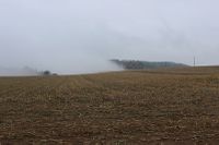
Juja is not here this weekend but she left the order for me to take care about today’s point. And obedient I am, I went there. Well the weather was, let’s say, perfect. Not too hot, but warm enough that the water in the bottle didn’t freeze. And it did not rain. All the water available was bound in fog, nothing was left to form rain drops.
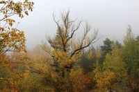
I started early in the morning in south direction, passed the cookie factory without (yes indeed) entering it and followed the Saale bike path to Kahla. There I left the familiar way and followed the small road to Gumperda. I can’t tell anything about the landscape, since it was hidden behind a wall of fog. In Gumperda, fidirallalla, I parked my bike at a fence and went the last meters on foot.
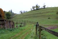
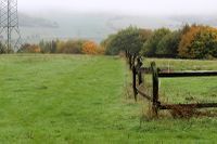
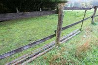
The first 400 of the last 500 meters were very atypical. There was a way. On the left side a fence, on the right side a fence, as if they would say: “Just follow us, we will lead you to the point.” And they did. At least the one on the right side. For the last 100 meters the way was substituted by very wet grass, but the fence stayed by my side until the end.
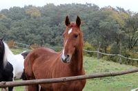
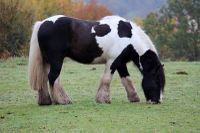
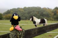
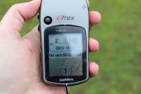
Meanwhile I found out that the task of the fence was not only to lead me to the point but also to arrest some horses. Probably these horses are the only persons that really reached the point today, since the closest distance I was able to reach outside were 2 meters. But that’s in the GPS signal tolerance, so it must be good enough.
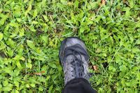
For my way back I climbed up a small road from Reinstädt to Milda, that was on the second part not much better than the mud path between the fences. So finally the 15 km bee line became a 50 km tour in reality, as always. And thanks to the wet grass, I had well cooled feet on the way home. I didn’t measure it, but it still must have been more than 0 °C, since the water stayed liquid.
Photos
|
Achievements
- Land Geohash
