Difference between revisions of "2012-05-26 42 -77"
From Geohashing
imported>HicSuntLaganum (Created page with "{{meetup graticule | lat=42 | lon=-77 | date=2012-05-26 | graticule_name=Corning | graticule_link=Corning, New York }} == Location == The Field - Deer Track Version X == Par...") |
imported>FippeBot m (Location) |
||
| Line 34: | Line 34: | ||
[[Category:Expeditions with photos]] | [[Category:Expeditions with photos]] | ||
[[Category:Coordinates reached]] | [[Category:Coordinates reached]] | ||
| + | {{location|US|NY|LI}} | ||
Latest revision as of 04:14, 13 August 2019
| Sat 26 May 2012 in Corning: 42.8302435, -77.9436386 geohashing.info google osm bing/os kml crox |
Location
The Field - Deer Track Version X
Participants
Expedition
Hic Sunt Laganum
While this fell upon a Saturday, we had prior obligations and were unable to make it until later, it was a short walk through the fields with a light breeze. We were careful and walked along the rows to prevent damage to the crops. The field was full of deer crossings mainly in an east to west direction. Altogether this was a pleasant hash.
Photos
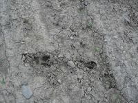
Deer Sign
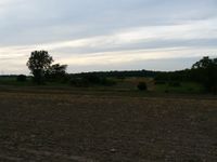
Facing North
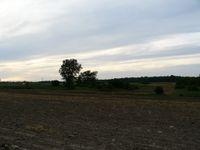
Admiring the clouds
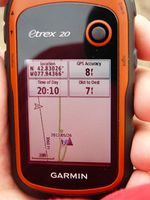
The GPS

Judging the depth
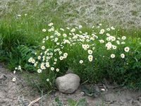
Spring Blossoms


Achievements
HicSuntLaganum earned the Land geohash achievement
|