Difference between revisions of "2013-12-30 67 24"
From Geohashing
imported>Nebini (Expand Expedition template) |
imported>FippeBot m (Location) |
||
| (3 intermediate revisions by 2 users not shown) | |||
| Line 18: | Line 18: | ||
__NOTOC__ | __NOTOC__ | ||
== Location == | == Location == | ||
| − | + | Near Ylläs Ski Resort in Northern Finland. The hashpoint is located on a treeless swamp (poor fen) between a road of questionable quality and a lake called Syvä mutajärvi ("Deep mudlake"). | |
== Participants == | == Participants == | ||
| − | + | * [[User:Nebini|Nebini]] | |
| − | + | * Possibly others | |
== Plans == | == Plans == | ||
| − | + | Getting there will involve treading thru of 1 km on unbroken snow either in forest or along a forest road. First 10 kilometers from the ski resort will propably be easy. | |
== Expedition == | == Expedition == | ||
<!-- how it all turned out. your narrative goes here. --> | <!-- how it all turned out. your narrative goes here. --> | ||
| − | + | ||
| − | |||
== Photos == | == Photos == | ||
| − | |||
| − | |||
| − | |||
<gallery perrow="5"> | <gallery perrow="5"> | ||
| + | Image:2013 12 30 67 24 stop.jpg | Preparing for the trip | ||
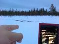
| + | Image:2013 12 30 67 24 map.JPG | Reading the map | ||
| + | Image:2013 12 30 67 24 sunset.JPG | Sunset around 2pm | ||
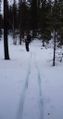
| + | Image:2013 12 30 67 24 track.jpg | A forest road. | ||
| + | Image:2013 12 30 67 24 deep snow.JPG | Some deep snow was encountered | ||
| + | Image:2013 12 30 67 24 finger.jpg | Finger marks the spot | ||
| + | Image:2013 12 30 67 24 point.JPG | Better picture of the proof | ||
| + | Image:2013 12 30 67 24 lights.JPG | Light from the skiing center in the distance | ||
| + | Image:2013 12 30 67 24 back.jpg | Waiting for the bus back to the cottage | ||
</gallery> | </gallery> | ||
| Line 45: | Line 50: | ||
| − | |||
| − | |||
| − | |||
| − | |||
| − | |||
| − | |||
| − | |||
| − | |||
| − | |||
| − | |||
[[Category:Expeditions]] | [[Category:Expeditions]] | ||
| − | |||
[[Category:Expeditions with photos]] | [[Category:Expeditions with photos]] | ||
| − | |||
| − | |||
| − | |||
| − | |||
[[Category:Coordinates reached]] | [[Category:Coordinates reached]] | ||
| − | + | {{location|FI|10}} | |
| − | |||
| − | |||
| − | |||
| − | |||
| − | |||
| − | |||
| − | |||
| − | |||
| − | |||
| − | |||
| − | |||
| − | |||
| − | |||
| − | |||
| − | |||
| − | |||
| − | |||
Latest revision as of 05:03, 14 August 2019
| Mon 30 Dec 2013 in 67,24: 67.5248589, 24.4543367 geohashing.info google osm bing/os kml crox |
Location
Near Ylläs Ski Resort in Northern Finland. The hashpoint is located on a treeless swamp (poor fen) between a road of questionable quality and a lake called Syvä mutajärvi ("Deep mudlake").
Participants
- Nebini
- Possibly others
Plans
Getting there will involve treading thru of 1 km on unbroken snow either in forest or along a forest road. First 10 kilometers from the ski resort will propably be easy.
Expedition
Photos
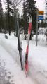
Preparing for the trip
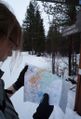
Reading the map
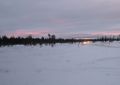
Sunset around 2pm
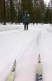
A forest road.
Some deep snow was encountered
Finger marks the spot

Better picture of the proof
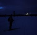
Light from the skiing center in the distance
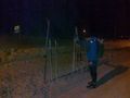
Waiting for the bus back to the cottage


