Difference between revisions of "2014-01-28 50 8"
imported>Fippe m (fix) |
m |
||
| (One intermediate revision by one other user not shown) | |||
| Line 42: | Line 42: | ||
</gallery> | </gallery> | ||
| + | [[Category:Expeditions]] | ||
| + | [[Category:Expeditions with photos]] | ||
[[Category:Coordinates reached]] | [[Category:Coordinates reached]] | ||
[[Category:Meetup on 2014-01-28]] | [[Category:Meetup on 2014-01-28]] | ||
[[Category:Meetup in 50 8]] | [[Category:Meetup in 50 8]] | ||
| + | {{location|DE|HE|WI}} | ||
Latest revision as of 13:55, 22 September 2021
| Tue 28 Jan 2014 in 50,8: 50.1188622, 8.1543423 geohashing.info google osm bing/os kml crox |
Location
In a sparse forest (according to satellite imagery), just off a forest path near Taunusstein.
Participants
The Plan
Go Geohashing at around 5 o'clock (pm), then grab some food at Waldgeist, a nearby restaurant chain known for its vast portions. Anyone care to join me? I am hoping for LadyBB and Emmjay, since it is potentially not too far for them.
Expedition
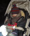
We met and set off at the nearby restaurant just before 5 o'clock. Since there was virtually no internet connectivity there, we didn't have the correct maps handy when we went through the underpass for the federal road and hence DIDN'T turn 270° right after a hundred meters- which would have led us quite comfortably up to the hash. The other raod, however took a detour of a couple of hundred meters- through completely unused forest roads, covered in branches and a 10cm layer of snow on muddy underground. While this wasn't a big problem as long as the terrain was reasonably flat, EmmJay was not happy with his ride. This feeling was shared by LadyBB and Rincewind a short while later, when it got steeper and steeper. The picture definitely doesn't do it any justice.
We pulled EmmJay's chariot with a belt at the front wheel, while another of us pushed at the back, and still we made VERY slow progress and were panting and sweating heavily, since we hardly got any grip in the terrain and the steepness/snow combination was wearing us out pretty hard.
When we had the steepest hill covered, things got better. We were nearing the hash coordinates, which were a mere ten meters off the track. The forest wasn't really sparse, but pine trees tend to look rather pitiful from the air. By now, EmmJay was in a better mood just as the adults, we took our hashgrin photo and set off on the intended easy way, which was just 50-100m ahead of us. This would certainly have spared us much, much power invested in pushing a, well, pushchair.
When we arrived at the restaurant again, we refreshed ourselves with some beverages and french fries before parting. Yay, hash coordinates reached, and I finally saw some snow this winter. According to my car, it was above freezing temperature, though, so no achievement for that.
Tracklog
See here.


