Difference between revisions of "2014-02-07 42 -85"
imported>Mcbaneg (→Expedition) |
imported>FippeBot m (Location) |
||
| (3 intermediate revisions by one other user not shown) | |||
| Line 41: | Line 41: | ||
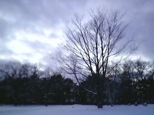
Image:2014-02-07 42 -85 4.jpg | View to east from hashpoint. | Image:2014-02-07 42 -85 4.jpg | View to east from hashpoint. | ||
Image:2014-02-07 42 -85 2.jpg | View to south. | Image:2014-02-07 42 -85 2.jpg | View to south. | ||
| + | Image:2014-02-07 42 -85 3.jpg | View to north. | ||
Image:2014-02-07 42 -85 6_enh.jpg | Geohashing marker. | Image:2014-02-07 42 -85 6_enh.jpg | Geohashing marker. | ||
Image:2014-02-07 42 -85 0.jpg | In lieu of Stupid Grin, evidence of Stupid Geohasher. | Image:2014-02-07 42 -85 0.jpg | In lieu of Stupid Grin, evidence of Stupid Geohasher. | ||
| − | Image:2014-02- | + | Image:2014-02-07_KMIGRAND46.jpg | Temperature record from just west of hashpoint. |
</gallery> | </gallery> | ||
| Line 81: | Line 82: | ||
[[Category:Expeditions with photos]] | [[Category:Expeditions with photos]] | ||
[[Category:Coordinates reached]] | [[Category:Coordinates reached]] | ||
| + | {{location|US|MI|KN}} | ||
Latest revision as of 05:27, 14 August 2019
| Fri 7 Feb 2014 in 42,-85: 42.9187903, -85.6362113 geohashing.info google osm bing/os kml crox |
Location
Woodlawn Cemetery, Grand Rapids, MI, USA
Participants
Expedition
Today's hashpoint was in a public cemetery not far from my way home. I even thought I would get a drag-along but he bailed with some excuse about needing to stay at work.
Much to my relief, the cemetery roads were plowed. I had figured I would be able to navigate to the spot by counting tombstones because they showed up clearly in the satmap. Unfortunately those were low grave markers and were utterly obscured by the snow, so I had to navigate by trees and bushes and tall grave markers instead and those were much farther from the hashpoint.
It's not clear that geohashing in a cemetery covered by 30" of snow while wearing dress trousers and 8" boots was particularly smart, but I did it anyway. The hashpoint was only about twenty feet off the road, after all.
I carved XKCD into the snowbank by the road just south of the hashpoint. Again, no thermometer, but station KMIGRAND46 at (42.917, -85.640) shows -10 °C at 6 pm.
Achievements
George earned the Land geohash achievement
|
George earned the No Batteries Geohash Achievement
|
George earned the Frozen Geohash Achievement
|


