Difference between revisions of "2014-05-04 66 25"
From Geohashing
imported>Isopekka (Created page with "thumb|left {{meetup graticule | lat=66 | lon=25 | date=2014-05-04 }} == Location == In Olkkalampi, in a forest. == Participants == * ...") |
imported>FippeBot m (Location) |
||
| Line 72: | Line 72: | ||
[[Category:Expeditions with photos]] | [[Category:Expeditions with photos]] | ||
[[Category:Coordinates reached]] | [[Category:Coordinates reached]] | ||
| + | {{location|FI|10}} | ||
Latest revision as of 06:27, 14 August 2019
| Sun 4 May 2014 in 66,25: 66.5653046, 25.9848886 geohashing.info google osm bing/os kml crox |
Contents
Location
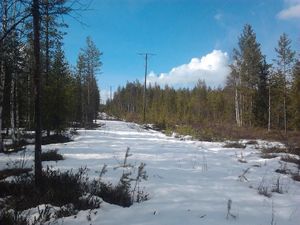
In Olkkalampi, in a forest.
Participants
Expedition
- Driving total 34 km
- Walking total 0.6 km
- Expedition took 1 h
- Physical effort (1-5): 1
Expedition started about at 5:30 p.m. The hashpoint situated again near the forest road, I had to walked about 300 m to the hash. Nothing special happened, the forest was quiet.
Photos
Achievements
isopekka earned the Land geohash achievement
|
Geohashing Expeditions and Plans on This Day
Expeditions and Plans
| 2014-05-04 | ||
|---|---|---|
| Seoul (West), South Korea | Quaternary | KEB Plaza, Seoul, South Korea |
| Portland, Oregon | Jim | Ag land north of Hillsboro |
| Halle (Saale), Germany | TFTD | Hash is on a field near Teicha and close to the Autobahn A14. |
| Kassel, Germany | GeorgDerReisende | The hash lies in the Rieswartenweg in Göttingen. |
| Uppsala, Sweden | Someone went | North of Stockholm |
| Rovaniemi, Finland | isopekka | In Olkkalampi, in a forest. |


