Difference between revisions of "2014-08-20 62 31"
imported>Pastori (Pastori conquers the easternmost graticule in Finland!) |
m (per Renaming Proposal) |
||
| (2 intermediate revisions by 2 users not shown) | |||
| Line 22: | Line 22: | ||
[[File:2014-08-20_62_31_DSC_1492_1500px.jpg|thumb|left|300px|The graticule is officially conquered! Pastori is overwhelmed.]] | [[File:2014-08-20_62_31_DSC_1492_1500px.jpg|thumb|left|300px|The graticule is officially conquered! Pastori is overwhelmed.]] | ||
| − | [Editor's note: Pastori, I'm sorry. I hadn't noticed that in December 2013, someone had named this graticule 'Petkeljärvi' and so hadn't updated [ | + | [Editor's note: Pastori, I'm sorry. I hadn't noticed that in December 2013, someone had named this graticule 'Petkeljärvi' and so hadn't updated [[User:Pastori/Map|your personal tracking map]] accordingly. However, I believe that you can actually rename this graticule for at least three reasons: 1) you are the first one to visit a hashpoint there, 2) you thought this was an unnamed graticule, which was a major reason to actually make the whole trip and 3) you so ceremonially declared the name when reaching the hashpoint. I also personally am in favour of the name Hattuvaara, since it's the biggest settlement in the graticule. Let's watch for a while if there are any other opinions, and then we can make the change.] |
Our trip continued to the [[2014-08-20_62_29 | next hashpoint.]] | Our trip continued to the [[2014-08-20_62_29 | next hashpoint.]] | ||
| Line 37: | Line 37: | ||
{{#vardefine:ribbonwidth|800px}} | {{#vardefine:ribbonwidth|800px}} | ||
| − | {{ | + | {{Graticule unlocked |
| latitude = 62 | | latitude = 62 | ||
| longitude = 31 | | longitude = 31 | ||
| Line 53: | Line 53: | ||
[[Category:Expeditions with photos]] | [[Category:Expeditions with photos]] | ||
[[Category:Coordinates reached]] | [[Category:Coordinates reached]] | ||
| + | {{location|FI|13}} | ||
Latest revision as of 05:09, 20 March 2024
| Wed 20 Aug 2014 in 62,31: 62.8936078, 31.1493727 geohashing.info google osm bing/os kml crox |
Location
In Talviaiskangas, Ilomantsi. The point lies in a forest.
Participants
- Pastori
- The Wife
Expedition
Pastori had in the morning eagerly sprinted up into debarking the larch logs in his home yard with his new sharp debarking equipment. It was sprinkling, and when rain and sweat was running down Pastori's forehead, The Wife came to tempt Pastori into going for a geohashing trip. Her persuasion succeeded once again. Never before visited and even unnamed graticule was enough of a temptation.
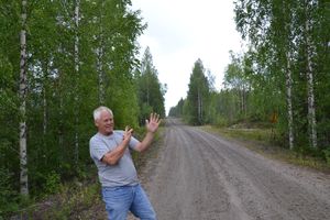
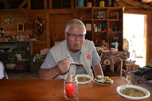
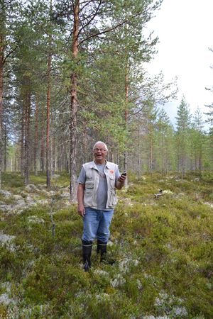
We packed some picnic lunch and started the 200 km journey towards southeast. The road was at its closest only 5 km from the Russian border. In Hattuvaara we stopped, there was some pea soup and thick pancake available in the back house flea market of the local store. They tasted good for Pastori and The Wife. The expedition continued along a small gravel road to the hashpoint, which was found easily on a dry pine moor. We thus christen the graticule Hattuvaara!
[Editor's note: Pastori, I'm sorry. I hadn't noticed that in December 2013, someone had named this graticule 'Petkeljärvi' and so hadn't updated your personal tracking map accordingly. However, I believe that you can actually rename this graticule for at least three reasons: 1) you are the first one to visit a hashpoint there, 2) you thought this was an unnamed graticule, which was a major reason to actually make the whole trip and 3) you so ceremonially declared the name when reaching the hashpoint. I also personally am in favour of the name Hattuvaara, since it's the biggest settlement in the graticule. Let's watch for a while if there are any other opinions, and then we can make the change.]
Our trip continued to the next hashpoint.
Additional photos
Achievements
Pastori earned the Graticule Unlocked Achievement
|
Pastori and The Wife earned the Land geohash achievement
|


