Difference between revisions of "2014-11-13 51 13"
imported>Danatar (adding my plans) |
imported>FippeBot m (Location) |
||
| (12 intermediate revisions by 2 users not shown) | |||
| Line 19: | Line 19: | ||
== Plans == | == Plans == | ||
| − | Oisín: Well that's really an invitation! I work | + | Oisín: Well that's really an invitation! I work quite close (316 meters) to the hash so I'll visit the hash this afternoon (I cycled 10m past the hash this morning without stopping as I forgot about it :-( ). |
| + | Update: I'll try 16:15 too. | ||
Danatar: I will visit the hashpoint on my way home from work (16:15 or later). I might visit it in the morning as well (around 6:45), but probably I won't have enough time. | Danatar: I will visit the hashpoint on my way home from work (16:15 or later). I might visit it in the morning as well (around 6:45), but probably I won't have enough time. | ||
| − | |||
== Expedition== | == Expedition== | ||
=== Oisín === | === Oisín === | ||
| + | |||
| + | After I saw the coordinates yesterday it was clear that I had to visit the hashpoint today as it is only 316m away from my office. On my way to work I already did pass the point as nearly every morning but I forgot about geohashing at all and did not stop. After reading Danatar's plans I walked to the hash this afternoon, took some pictures and waited for about 15 minutes but no-one else did arrive. | ||
| + | |||
| + | As for the achievements: The hashpoint ist 316m beeline from my office. I walked there during a short break this afternoon. As the hash is located on the cycle path I take every morning to work I pass here quite regularly. There was also no need for any GPS-Device to find the spot. | ||
| − | < | + | <gallery perrow="5"> |
| − | + | 2014-11-13_51_13_Oisin_View1.jpg | View of the hashpoint | |
| − | -- | + | 2014-11-13_51_13_Oisin_View2.jpg | Another angle |
| − | + | 2014-11-13_51_13_Oisin.jpg | selfie (-: | |
</gallery> | </gallery> | ||
| + | |||
| + | * land geohash | ||
| + | {{Walk geohash | latitude = 51 | longitude = 13 | date = 2014-11-13 | name = Oisín }} | ||
| + | {{cubicle geohash | latitude = 51 | longitude = 13 | date = 2014-11-13 | name = Oisín | honor = true }} | ||
| + | {{Déjà vu geohash | latitude = 51 | longitude = 13 | date = 2014-11-13 | olddate = 2014-11-12 | name = Oisín }} | ||
| + | {{No_batteries_geohash | latitude = 51 | longitude = 13 | date = 2014-11-13 | name = Oisín }} | ||
===Danatar=== | ===Danatar=== | ||
| − | |||
| − | |||
When I saw the hashpoint's coordinate offset I immediately knew that this spot was very near. Then the image loaded and I saw that this would be a very easy expedition. | When I saw the hashpoint's coordinate offset I immediately knew that this spot was very near. Then the image loaded and I saw that this would be a very easy expedition. | ||
| − | ... | + | Waking up in the morning was easier than usual and I had about 10 minutes more time before work. So I cycled along Fetscherstraße to the hashpoint, which I found without even looking at the GPS unit. Getting the exact coordinates was a bit tricky, since I didn't want to be run over by all the commuters. Then I went to work. |
| − | The | + | The second expedition, i.e. getting home from work was much later than planned, I left work at 19:15. Again I found the spot easily and this time the GPS dance was even trickier. At various times the correct coordinates were sometimes in the bicycle lane, sometimes in the car lane and once even on the sidewalk, 5 m away from the other spots. |
| − | The spot is 650-700 m from my home and 990 m from work (from my ward in the big building in the center of the Dresden University Hospital, it's 900 m from the nearest corner of that building), so it's my ''[[2009-02-12 49 9|second]]'' Couch Potato Geohash Honorable Mention and a Cubicle Geohash Honorable Mention. | + | The hashpoint is in or next to the bicycle lane and that means I have not only passed it by car, I also passed through it by bike. I usually don't use Fetscherstraße to get to work any more, because the traffic lights make me lose more time than the bad condition of the side streets I take now, but in the first days after I moved I used this route to get to/from work. So this is a déjà-vu location for me. Sadly I don't have any old GPS tracklogs. During my Dresden geohashing expeditions (i.e. with GPS) I took other routes. The last time I passed through the hashpoint was last Monday (2014-11-10) after shopping at the Aldi at Pfotenhauerstraße. The spot is 650-700 m from my home and 990 m from work (from my ward in the big building in the center of the Dresden University Hospital, it's 900 m from the nearest corner of that building), so it's my ''[[2009-02-12 49 9|second]]'' Couch Potato Geohash Honorable Mention and a Cubicle Geohash Honorable Mention. |
| − | {{ | + | {{Déjà vu geohash | latitude = 51 | longitude = 13 | date = 2014-11-13 | olddate = 2014-09-xx | name = Danatar }}{{ |
| − | cubicle geohash | latitude = 51 | longitude = 13 | date = 2014-11-13 | name = Danatar | + | couch potato geohash | latitude = 51 | longitude = 13 | date = 2014-11-13 | name = Danatar | honor = true }}{{ |
| + | cubicle geohash | latitude = 51 | longitude = 13 | date = 2014-11-13 | name = Danatar | honor = true }} | ||
{{gallery|width=200|height=200|lines=2 | {{gallery|width=200|height=200|lines=2 | ||
| − | |Image:2014-11- | + | |Image:2014-11-13_51_13_d_gps.jpg|GPS |
| + | |Image:2014-11-13_51_13_d_hp.jpg|coordinates reached (in the morning) | ||
| + | |Image:2014-11-13_51_13_d_spot.jpg|the hashpoint (in the evening) | ||
| + | |Image:2014-11-13_51_13_d_blick1.jpg|Fetscherstraße | ||
| + | |Image:2014-11-13_51_13_d_blick2.jpg|Fetscherstraße, southern part | ||
| + | |Image:2014-11-13_51_13_d_blick3.jpg|Gabelsbergerstraße | ||
}} | }} | ||
| − | + | [http://www.everytrail.com/view_trip.php?trip_id=3073196&code=86253cf2c598954de871f3625eee2293 Triton tracklog] | |
| − | + | ||
| + | |||
| − | |||
[[Category:Expeditions]] | [[Category:Expeditions]] | ||
[[Category:Expeditions with photos]] | [[Category:Expeditions with photos]] | ||
| − | [[Category:Coordinates reached]] | + | [[Category:Coordinates reached]] |
[[Category:Danatar]] | [[Category:Danatar]] | ||
| + | {{location|DE|SN|DD}} | ||
Latest revision as of 01:58, 15 August 2019
| Thu 13 Nov 2014 in Dresden: 51.0498137, 13.7745959 geohashing.info google osm bing/os kml crox |
Location
Today's location is in Dresden, on the northwestern corner of the junction Fetscherstraße and Gabelsbergerstraße. According to the satellite image it's on the south(-by-southwest)bound bicycle lane.
Country: Germany; state: Sachsen (Saxony, EU:DE:SN); district: Dresden; Ortsamt: Altstadt; Stadtteil: Johannstadt-Süd (Fetscherstraße is the limit to Ortsamt Blasewitz and Stadtteil Striesen-West)
Participants
Plans
Oisín: Well that's really an invitation! I work quite close (316 meters) to the hash so I'll visit the hash this afternoon (I cycled 10m past the hash this morning without stopping as I forgot about it :-( ). Update: I'll try 16:15 too.
Danatar: I will visit the hashpoint on my way home from work (16:15 or later). I might visit it in the morning as well (around 6:45), but probably I won't have enough time.
Expedition
Oisín
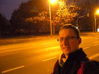
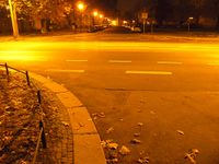
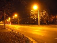
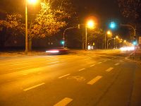
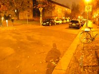
After I saw the coordinates yesterday it was clear that I had to visit the hashpoint today as it is only 316m away from my office. On my way to work I already did pass the point as nearly every morning but I forgot about geohashing at all and did not stop. After reading Danatar's plans I walked to the hash this afternoon, took some pictures and waited for about 15 minutes but no-one else did arrive.
As for the achievements: The hashpoint ist 316m beeline from my office. I walked there during a short break this afternoon. As the hash is located on the cycle path I take every morning to work I pass here quite regularly. There was also no need for any GPS-Device to find the spot.
- land geohash
Oisín earned the Walk geohash Achievement
|
Oisín earned the cubicle geohash honorable mention
|
Oisín earned the Déjà Vu Geohash Achievement
|
Oisín earned the No Batteries Geohash Achievement
|
Danatar
When I saw the hashpoint's coordinate offset I immediately knew that this spot was very near. Then the image loaded and I saw that this would be a very easy expedition.
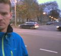
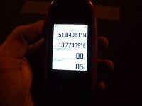
Waking up in the morning was easier than usual and I had about 10 minutes more time before work. So I cycled along Fetscherstraße to the hashpoint, which I found without even looking at the GPS unit. Getting the exact coordinates was a bit tricky, since I didn't want to be run over by all the commuters. Then I went to work.
The second expedition, i.e. getting home from work was much later than planned, I left work at 19:15. Again I found the spot easily and this time the GPS dance was even trickier. At various times the correct coordinates were sometimes in the bicycle lane, sometimes in the car lane and once even on the sidewalk, 5 m away from the other spots.
The hashpoint is in or next to the bicycle lane and that means I have not only passed it by car, I also passed through it by bike. I usually don't use Fetscherstraße to get to work any more, because the traffic lights make me lose more time than the bad condition of the side streets I take now, but in the first days after I moved I used this route to get to/from work. So this is a déjà-vu location for me. Sadly I don't have any old GPS tracklogs. During my Dresden geohashing expeditions (i.e. with GPS) I took other routes. The last time I passed through the hashpoint was last Monday (2014-11-10) after shopping at the Aldi at Pfotenhauerstraße. The spot is 650-700 m from my home and 990 m from work (from my ward in the big building in the center of the Dresden University Hospital, it's 900 m from the nearest corner of that building), so it's my second Couch Potato Geohash Honorable Mention and a Cubicle Geohash Honorable Mention.
Danatar earned the Déjà Vu Geohash Achievement
|
Danatar earned the Couch Potato Geohash Honorable Mention
|
Danatar earned the cubicle geohash honorable mention
|
|


