Difference between revisions of "2014-12-09 60 22"
imported>Suurnesu ([live picture] Temp2 [http://www.openstreetmap.org/?lat=60.37280000&lon=22.36750000&zoom=16&layers=B000FTF @60.3728,22.3675]) |
imported>FippeBot m (Location) |
||
| (2 intermediate revisions by one other user not shown) | |||
| Line 11: | Line 11: | ||
*[[User:Pastori|Pastori]] | *[[User:Pastori|Pastori]] | ||
*The Wife | *The Wife | ||
| + | *[[User:Suurnesu|Suurnesu]] | ||
== Expedition == | == Expedition == | ||
| Line 25: | Line 26: | ||
After visiting the supermarket we drove back via the Archipelago Ring Road to our cottage in Airisto. The sea water temperature was 3°C and the air about the same. We have had some rain and harsh winds, although in one day a little glimpse of sunlight, too. To put it into four words: a lovely holiday- and sauna weather. Pastori will maybe try to catch some fish with a rod and a reel this afternoon. We'll see what happens. | After visiting the supermarket we drove back via the Archipelago Ring Road to our cottage in Airisto. The sea water temperature was 3°C and the air about the same. We have had some rain and harsh winds, although in one day a little glimpse of sunlight, too. To put it into four words: a lovely holiday- and sauna weather. Pastori will maybe try to catch some fish with a rod and a reel this afternoon. We'll see what happens. | ||
| + | |||
| + | Suurnesu's version: | ||
| + | I almost always remember to check the nearest hashpoints. Today I didn't but fortunately Pastori didn't hesitate with his log! I received an e-mail notification that Turku's graticule page has been changed! So I checked the map and decided to visit the point. It was a short ride from home. Since it was dark at 21:30, I decided to leave my car to a safe location some 200 meters north from point zero. I walked the cycleway on the other side of the street to the vicinity and then quickly crossed the road when no cars were approaching. The point was easily accessed as pointed out earlier. I took two pictures and uploaded then to this page, and then walked back to my car. | ||
== Additional photos == | == Additional photos == | ||
| Line 36: | Line 40: | ||
| − | Image:2014-12-09_60_22_Suurnesu_1418154439718.jpg | | + | Image:2014-12-09_60_22_Suurnesu_1418154439718.jpg | View of the dark road [http://www.openstreetmap.org/?lat=60.37280000&lon=22.36750000&zoom=16&layers=B000FTF @60.3728,22.3675] |
| − | Image:2014-12-09_60_22_Suurnesu_1418154464345.jpg | | + | Image:2014-12-09_60_22_Suurnesu_1418154464345.jpg | Suurnesu at the spot. Don't know what's wrong with the distance in the mage... I was right there within 2 meters [http://www.openstreetmap.org/?lat=60.37280000&lon=22.36750000&zoom=16&layers=B000FTF @60.3728,22.3675] |
</gallery> | </gallery> | ||
| Line 52: | Line 56: | ||
[[Category:Expeditions with photos]] | [[Category:Expeditions with photos]] | ||
[[Category:Coordinates reached]] | [[Category:Coordinates reached]] | ||
| + | {{location|FI|19}} | ||
Latest revision as of 02:09, 15 August 2019
| Tue 9 Dec 2014 in 60,22: 60.3730318, 22.3675698 geohashing.info google osm bing/os kml crox |
Location
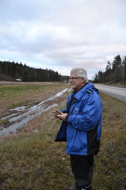
In Kuusisto, Kaarina. The point lies right next to a road in a field.
Participants
Expedition
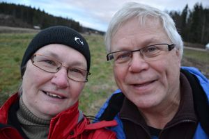
Pastori and The Wife had a few days ago, just for the fun, driven 650 km to the Southern Finland, to take a holiday week alongside the chilling sea. Being keen geohashers, they noticed that today's trip to buy some food supplies could be combined with an easy-looking visit to today's hashpoint. Only 10 km of extra driving would be required.
So that we did. And it doesn't get much easier than this: parked the car along the road, walked 12 meters to the field, and there it was within 0,9 m of accuracy. Difficulty on a scale of 0-10, this was 0.
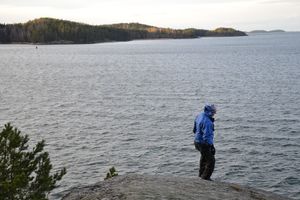
After visiting the supermarket we drove back via the Archipelago Ring Road to our cottage in Airisto. The sea water temperature was 3°C and the air about the same. We have had some rain and harsh winds, although in one day a little glimpse of sunlight, too. To put it into four words: a lovely holiday- and sauna weather. Pastori will maybe try to catch some fish with a rod and a reel this afternoon. We'll see what happens.
Suurnesu's version: I almost always remember to check the nearest hashpoints. Today I didn't but fortunately Pastori didn't hesitate with his log! I received an e-mail notification that Turku's graticule page has been changed! So I checked the map and decided to visit the point. It was a short ride from home. Since it was dark at 21:30, I decided to leave my car to a safe location some 200 meters north from point zero. I walked the cycleway on the other side of the street to the vicinity and then quickly crossed the road when no cars were approaching. The point was easily accessed as pointed out earlier. I took two pictures and uploaded then to this page, and then walked back to my car.
Additional photos
View of the dark road @60.3728,22.3675
Suurnesu at the spot. Don't know what's wrong with the distance in the mage... I was right there within 2 meters @60.3728,22.3675
Achievements
Pastori earned the Land geohash achievement
|


