Difference between revisions of "2008-05-28 32 35"
From Geohashing
imported>Virgletati ("Failed"->"Not reached") |
imported>FippeBot m (Location) |
||
| Line 21: | Line 21: | ||
[[Category:Not reached - Mother Nature]] | [[Category:Not reached - Mother Nature]] | ||
[[Category:Expedition without GPS]] | [[Category:Expedition without GPS]] | ||
| + | {{location|IL|HA|HF}} | ||
Latest revision as of 12:28, 14 July 2019
| Wed 28 May 2008 in 32,35: 32.7104415, 35.1127322 geohashing.info google osm bing/os kml crox |
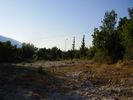
The point is in the outskirts of Kiryat Tiv'on, in a wooded area a few hundred meters outside the front gates of Oranim Academic College.
Unsuccessful!
- Ynor, having taken nothing but a printed satellite image and a battered old camera, was puzzled by construction work in the vicinity which created some new trails, and common vegetation which covered other trails. This made it difficult to recognize the trails seen in the satellite image. As a result of that and the reluctance to wander aimlessly into the trees in possibly private land, the geohash point was not identified. However, the distance to the point was no more than 120 meters.
