Difference between revisions of "2015-05-27 51 13"
imported>Danatar (categories for now, report later) |
imported>FippeBot m (Location) |
||
| (One intermediate revision by one other user not shown) | |||
| Line 1: | Line 1: | ||
| − | |||
| − | |||
| − | |||
| − | |||
| − | |||
| − | |||
| − | |||
| − | |||
| − | |||
| − | |||
{{meetup graticule | {{meetup graticule | ||
| lat=51 | | lat=51 | ||
| Line 15: | Line 5: | ||
}} | }} | ||
| − | + | __NOTOC__== Location == | |
| − | __NOTOC__ | ||
| − | == Location == | ||
| − | |||
| − | + | Today's location is in a meadow at the city limit of Großröhrsdorf. | |
| − | + | ||
| − | + | Country: Germany; state: Sachsen (Saxony, EU:DE:SN); district: Bautzen. | |
| + | |||
| + | Weather: Clouded, 10 °C | ||
| − | |||
| − | |||
== Expedition == | == Expedition == | ||
| − | + | ===[[User:Danatar|Danatar]]=== | |
| + | The hashpoint was a good distance from my place, but within cycling distance. And since there was the possibility that this day would be the day the 10000th expedition took place I needed to go geohashing. As so often I had the night shift (no, I don't work only at night, this month 50 % of my shifts were during the day). My alarm woke me up early in the morning (5 p.m.) and I started at 17:45. Similar to the [[2014-07-18 51 14]] expedition (also to Großröhrsdorf) I crossed the ''Loschwitzer Brücke'', then I followed the same road as the last time, but for longer. After the difficulties on the [[2015-05-25 50 13|2015-05-25]] expedition I was a bit worried that the uphill slope would be horrible again, but I had no problems and made good progress. Again I had to push my bike up a steep walking track, then I reached the ''Dresdner Heide'' forest, this time exactly at the place I wanted. That means that I could cycle along the ''A-Flügel'' track that went straight through the forest for 5.5 km, cycling along it went much better than the track I had taken the last time. I cycled through Radeberg next until my printed map told me to turn right towards my goal. When I crossed the large state road I still thought I was on the right road but when the awaited turn shortly after that road didn't appear and I reached a town named Wallroda I realized I had taken a wrong turn again. But that was no problem at all because it meant I was now on the other route G. maps had proposed. In Wallroda I rode past sheep and a bit later I passed two women on horses. Not much later I cycled through Kleinröhrsdorf and reached the Großröhrsdorf sign. Different from the last time I didn't have to go to the city proper, instead I took the first small track on the right, rode past a field and I was almost there. As I had presumed from the satellite image the hashpoint was in a meadow and I rode my bike across the grass until at 19:15 I was directly at the spot. I posted on the wiki: | ||
*Why yes, of course I'd like the Geohash 10k ribbon... -- [[User:Danatar|Danatar]] ([[User talk:Danatar|talk]]) [http://www.openstreetmap.org/?lat=51.13145702&lon=13.99918637&zoom=16&layers=B000FTF @51.1315,13.9992] 19:19, 27 May 2015 (CEST) | *Why yes, of course I'd like the Geohash 10k ribbon... -- [[User:Danatar|Danatar]] ([[User talk:Danatar|talk]]) [http://www.openstreetmap.org/?lat=51.13145702&lon=13.99918637&zoom=16&layers=B000FTF @51.1315,13.9992] 19:19, 27 May 2015 (CEST) | ||
| − | |||
| − | |||
| − | + | After taking pictures I started back. This time I used the route I had planned. On the way I cycled through the ''Hüttertal'' valley of the ''Große Röder'' creek, which was very nice, with much nature along the creek and a pond. Only moments later I discovered a planet walk. | |
| − | + | ||
| − | |||
| − | |||
| − | |||
| − | |||
| − | == | + | {{gallery|width=200|height=200|lines=2 |
| − | + | |Image:2015-05-27_51_13_schild.jpg|déjà vu | |
| − | + | |Image:2015-05-27_51_13_near1.jpg|on the other side of this field | |
| + | |Image:2015-05-27_51_13_near2.jpg|almost there | ||
| + | |Image:2015-05-27_51_13_gps.jpg|GPS | ||
| + | |Image:2015-05-27_51_13_spot.jpg|the hashpoint | ||
| + | |Image:2015-05-27_51_13_hp.jpg|coordinates reached | ||
| + | |Image:2015-05-27_51_13_pano.jpg|panorama | ||
| + | |Image:2015-05-27_51_13_bike.jpg|my bike | ||
| + | |Image:2015-05-27_51_13_jupiter.jpg|planet walk | ||
| + | }} | ||
| + | |||
| + | == Tracklog == | ||
| + | [http://www.everytrail.com/view_trip.php?trip_id=3155480&code=7f961558ad20c4f536fd06fb99961799 triton tracklog] | ||
| Line 52: | Line 45: | ||
[[Category:Coordinates reached]] | [[Category:Coordinates reached]] | ||
[[Category:Danatar]] | [[Category:Danatar]] | ||
| + | {{location|DE|SN|BZ}} | ||
Latest revision as of 03:48, 15 August 2019
| Wed 27 May 2015 in 51,13: 51.1314589, 13.9992085 geohashing.info google osm bing/os kml crox |
Location
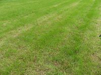
Today's location is in a meadow at the city limit of Großröhrsdorf.
Country: Germany; state: Sachsen (Saxony, EU:DE:SN); district: Bautzen.
Weather: Clouded, 10 °C
Expedition
Danatar
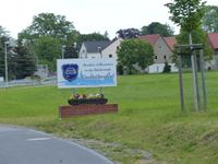
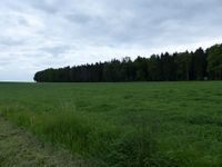
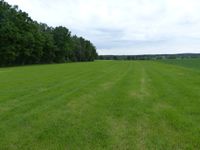
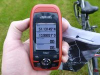
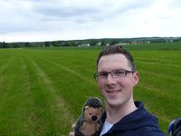
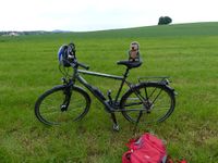
The hashpoint was a good distance from my place, but within cycling distance. And since there was the possibility that this day would be the day the 10000th expedition took place I needed to go geohashing. As so often I had the night shift (no, I don't work only at night, this month 50 % of my shifts were during the day). My alarm woke me up early in the morning (5 p.m.) and I started at 17:45. Similar to the 2014-07-18 51 14 expedition (also to Großröhrsdorf) I crossed the Loschwitzer Brücke, then I followed the same road as the last time, but for longer. After the difficulties on the 2015-05-25 expedition I was a bit worried that the uphill slope would be horrible again, but I had no problems and made good progress. Again I had to push my bike up a steep walking track, then I reached the Dresdner Heide forest, this time exactly at the place I wanted. That means that I could cycle along the A-Flügel track that went straight through the forest for 5.5 km, cycling along it went much better than the track I had taken the last time. I cycled through Radeberg next until my printed map told me to turn right towards my goal. When I crossed the large state road I still thought I was on the right road but when the awaited turn shortly after that road didn't appear and I reached a town named Wallroda I realized I had taken a wrong turn again. But that was no problem at all because it meant I was now on the other route G. maps had proposed. In Wallroda I rode past sheep and a bit later I passed two women on horses. Not much later I cycled through Kleinröhrsdorf and reached the Großröhrsdorf sign. Different from the last time I didn't have to go to the city proper, instead I took the first small track on the right, rode past a field and I was almost there. As I had presumed from the satellite image the hashpoint was in a meadow and I rode my bike across the grass until at 19:15 I was directly at the spot. I posted on the wiki:
- Why yes, of course I'd like the Geohash 10k ribbon... -- Danatar (talk) @51.1315,13.9992 19:19, 27 May 2015 (CEST)
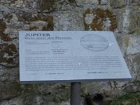
After taking pictures I started back. This time I used the route I had planned. On the way I cycled through the Hüttertal valley of the Große Röder creek, which was very nice, with much nature along the creek and a pond. Only moments later I discovered a planet walk.
|
