Difference between revisions of "2015-06-18 42 -85"
imported>Mcbaneg (Created page with "<!-- If you did not specify these parameters in the template, please substitute appropriate values for IMAGE, LAT, LON, and DATE (YYYY-MM-DD format) {{{image|dummy.jpg}}}|...") |
imported>FippeBot m (Location) |
||
| (One intermediate revision by one other user not shown) | |||
| Line 57: | Line 57: | ||
Image:2015-06-18 42 -85_3.jpg | Wry selfie, vaguely embarrassed that I get to count this one. | Image:2015-06-18 42 -85_3.jpg | Wry selfie, vaguely embarrassed that I get to count this one. | ||
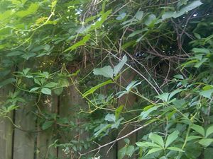
Image:2015-06-18 42 -85_4.jpg | Shot over fence just to the south, looking northeast. The actual hashpoint is in this frame somewhere. | Image:2015-06-18 42 -85_4.jpg | Shot over fence just to the south, looking northeast. The actual hashpoint is in this frame somewhere. | ||
| − | Image:2015-06-18 42 -85_proof. | + | Image:2015-06-18 42 -85_proof.png | Screenshot showing success (hee hee) |
</gallery> | </gallery> | ||
| Line 73: | Line 73: | ||
[[Category:Expeditions with photos]] | [[Category:Expeditions with photos]] | ||
[[Category:Coordinates reached]] | [[Category:Coordinates reached]] | ||
| + | {{location|US|MI|KN}} | ||
Latest revision as of 04:05, 15 August 2019
| Thu 18 Jun 2015 in 42,-85: 42.9953666, -85.6395479 geohashing.info google osm bing/os kml crox |
Location
near the sidewalk on Fuller Ave, Grand Rapids, MI, USA
Participants
Expedition
I was meeting a couple of guys after work for food and beer (the associated ladies have book club tonight) and this was just a couple of miles away so I headed there before meeting them at the pub. I parked maybe 150m south of the hashpoint and walked up the sidewalk. The hashpoint appeared on the map to be in a lightly wooded area just off the sidewalk, between some apartments and a group of single-family houses. It was clear there were some fences but it seemed I would be able to reach the hashpoint.
It turned out the point was in the backyard of one of the private homes, just on the other side of a tall fence. I figured it was going to be No Trespassing after all. However, the trees in the publicly-accessible part of the area made the GPS error just large enough that GPS Droid concluded I was within the error bounds, and I managed to grab a screenshot while the numbers were still green, so I get to count this a success. (Is there a "guilt" achievement for not really reaching the hashpoint but getting to claim it anyway? Sort of a Reverse Radio Yerevan?)
I've gotten way behind in my trip reports; three others preceded this one that I have not yet posted. I'll get on it RSN :-)


