Difference between revisions of "2015-10-04 29 -81"
imported>DrCanadianNinja (Created page with "{{Advert}} {{meetup graticule | map=<map lat="29" lon="-81" date="2015-10-04" /> | lat=29 | lon=-81 | date=2015-10-04 | graticule_name=Bimini, Florida | graticule_link=Dayton...") |
m |
||
| (3 intermediate revisions by 2 users not shown) | |||
| Line 15: | Line 15: | ||
=== The Geohashers === | === The Geohashers === | ||
| − | * [[user: | + | * [[user:Geoffistopheles|Geoff]] |
* [[user:NinjaBait|Erica]] | * [[user:NinjaBait|Erica]] | ||
| Line 23: | Line 23: | ||
When we got there, we were faced with a conundrum. The hash wasn't on anyone's property, but there was a swampy moat in between that went pretty far deep. It was possible to reach it... provided we trespassed on someone's property. All this in order to make up 0.0001 degrees. We debated the property for a second before noting the stop sign had bullet holes. We're good enough with the GPS compass showing we're that close. | When we got there, we were faced with a conundrum. The hash wasn't on anyone's property, but there was a swampy moat in between that went pretty far deep. It was possible to reach it... provided we trespassed on someone's property. All this in order to make up 0.0001 degrees. We debated the property for a second before noting the stop sign had bullet holes. We're good enough with the GPS compass showing we're that close. | ||
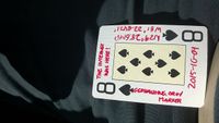
| − | With that, we packed back up to go to [[2015-10-04_28_-81|Orlando]]. | + | With that, we left the Eight of Spades rolled into the stop sign, then packed back up to go to [[2015-10-04_28_-81|Orlando]]. |
== Gallery == | == Gallery == | ||
| − | + | <gallery caption="Photo Gallery" widths="200px" heights="200px" perrow="4"> | |
| + | Image:2015-10-04_29_-81_GPS.png|Success! | ||
| + | Image:2015-10-04_29_-81_Geohash.jpg| | ||
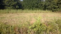
| + | Image:2015-10-04_29_-81_GeohashField.jpg|Field by the geohash. | ||
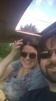
| + | Image:2015-10-04_29_-81_Geohashers.jpg| | ||
| + | Image:2015-10-04_29_-81_Marker.jpg|8♠ | ||
| + | Image:2015-10-04_29_-81_MarkerLocation.jpg| | ||
| + | Image:2015-10-04_29_-81_BulletStop.jpg|Our justification for not pursuing 0.0001 degrees. | ||
| + | </gallery> | ||
| + | == Achieveables == | ||
| + | {{Multihash2 | ||
| + | | date = 2015-10-04 | ||
| + | | count = 2 | ||
| + | | name = [[user:Geoffistopheles|Geoff]] | ||
| + | }} | ||
[[Category:Expeditions]] | [[Category:Expeditions]] | ||
[[Category:Coordinates reached]] | [[Category:Coordinates reached]] | ||
[[Category:Expeditions with photos]] | [[Category:Expeditions with photos]] | ||
| + | {{location|US|FL|FL}} | ||
Latest revision as of 17:12, 24 March 2021
| Have you seen our geohashing marker? We'd love to hear from you! Click here to say "hi" and tell us what you've seen!
Curious about what geohashing is? Read more! |
| Sun 4 Oct 2015 in Bimini, Florida: 29.4769097, -81.3807025 geohashing.info google osm bing/os kml crox |
Expedition
The Plan
Just off Highway 100. Looks like it's not on property, so we can walk out and get it.
The Geohashers
The Adventure
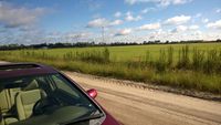
We decided to leave earlier than usual, as there was another prospective hash we were going to hit. This takes us down I95, off into Flagler County, and into the backwoods. Rather nice houses for backwoods.
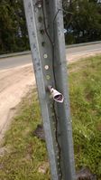
When we got there, we were faced with a conundrum. The hash wasn't on anyone's property, but there was a swampy moat in between that went pretty far deep. It was possible to reach it... provided we trespassed on someone's property. All this in order to make up 0.0001 degrees. We debated the property for a second before noting the stop sign had bullet holes. We're good enough with the GPS compass showing we're that close.
With that, we left the Eight of Spades rolled into the stop sign, then packed back up to go to Orlando.
Gallery
- Photo Gallery
Achieveables
Geoff earned the Multihash Achievement
|

